IMAGES TAKEN NEAR TO
King Street, DUKINFIELD, SK16 4LF

Introduction

This page details the photographs taken nearby to King Street, SK16 4LF by members of the Geograph project.

The Geograph project started in 2005 with the aim of publishing, organising and preserving representative images for every square kilometre of Great Britain, Ireland and the Isle of Man.

There are currently over 7.5m images from over14,400 individuals and you can help contribute to the project by visiting https://www.geograph.org.uk

Image Map


Images are licensed for reuse under creativecommons.org/licenses/by-sa/2.0
Notes
  • Clicking on the map will re-center to the selected point.
  • The higher the marker number, the further away the image location is from the centre of the postcode.

Image Listing (123 Images Found)

Images are licensed for reuse under creativecommons.org/licenses/by-sa/2.0
  • ...
Image
Details
Distance
1
Dukinfield Old Post Office
The original Post Office building in Dukinfield opposite the Town Hall.
Image: © Gerald England Taken: 8 Sep 2008
0.01 miles
2
Dukinfield Old Post Office
The Old Post Office building in Dukinfield. Part of it is now occupied by a newsagents. Image Image
Image: © Gerald England Taken: 13 Mar 2013
0.01 miles
3
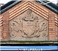
Dukinfield Old Post Office: Architectural detail (1)
Coat of arms/shield on the left hand side of the old Post Office Image building.
Image: © Gerald England Taken: 13 Mar 2013
0.01 miles
4
Dukinfield Old Post Office: Architectural detail (2)
Detail from the righthand side of the top of the old Post Office Image building.
Image: © Gerald England Taken: 13 Mar 2013
0.01 miles
5
Lieutenant Colonel Robert Duckenfield
Robert Duckenfield of Dukinfield Hall 1619 -1689. A man of the puritan faith and who in Cromwell's parliamentary cause, distingiushing himself in battle. He commanded the forces which secured the Isle of Man. He was appointed to Cromwell's 'Little Parliament' in 1653.
Image: © Alan Bate Taken: 2 Dec 2009
0.02 miles
6
NatWest Bank, Dukinfield
On the corner of King Street and Chapel Street opposite the Town Hall, this branch of the NatWest is Dukinfield's only bank. It is due to close soon which will leave the town bankless. Image
Image: © Gerald England Taken: 13 Mar 2013
0.02 miles
7
Coat of Arms above the NatWest Bank
The Coat of Arms above the NatWest Bank Image
Image: © Gerald England Taken: 13 Mar 2013
0.02 miles
8
Dukinfield Town Hall
Dukinfield Town Hall in front of which stands a statue of Lieutenant Colonel Robert Duckenfield 1619-1689.
Image: © Alan Bate Taken: 2 Dec 2009
0.02 miles
9
Dukinfield Town Hall
When Dukinfield Town Hall was opened, on June 15, 1901, it was the culmination of the campaign for borough status that had started almost four years before. The imposing building, constructed in Domestic Gothic style, was the embodiment of the town’s newly acquired civic status. For the following three-quarters of a century the Town Hall was home to Dukinfield Urban District Council. However, following the creation of Tameside Metropolitan Borough Council, in 1974, it became home to the new borough’s education department. After council services were centralised in Ashton in the 1980s, the Town Hall became Tameside’s borough register office and this is still based there. The old Council Chamber was converted into a snooker hall and the Jubilee Hall and Lesser Hall continue to be popular venues for family celebrations and other social events. http://www.tameside.gov.uk/buildings/dukinfieldth/history - History of Dukinfield Town Hall (Tameside.gov.uk)
Image: © David Dixon Taken: 4 Jun 2011
0.02 miles
10
Corner of King Street and Chapel Street
On one corner is Martins Bakers. On the other corner is the Nisa Local store. This was previously the NatWest bank Image
Image: © Gerald England Taken: 18 Mar 2023
0.02 miles
  • ...