IMAGES TAKEN NEAR TO
Village View, STALYBRIDGE, SK15 3HX

Introduction

This page details the photographs taken nearby to Village View, SK15 3HX by members of the Geograph project.

The Geograph project started in 2005 with the aim of publishing, organising and preserving representative images for every square kilometre of Great Britain, Ireland and the Isle of Man.

There are currently over 7.5m images from over14,400 individuals and you can help contribute to the project by visiting https://www.geograph.org.uk

Image Map


Images are licensed for reuse under creativecommons.org/licenses/by-sa/2.0
Notes
  • Clicking on the map will re-center to the selected point.
  • The higher the marker number, the further away the image location is from the centre of the postcode.

Image Listing (56 Images Found)

Images are licensed for reuse under creativecommons.org/licenses/by-sa/2.0
  • ...
Image
Details
Distance
1
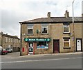
Manor Pharmacy
On Huddersfield Road, Millbrook. The shop was previously the Post Office Image but that has now moved into a convenience store across the road.
Image: © Gerald England Taken: 24 Oct 2012
0.01 miles
2
Millbrook Post Office
On Huddersfield Road.
Image: © Gerald England Taken: 28 Apr 2009
0.02 miles
3
The Hare & Hounds, Stalybridge
On Huddersfield Road.
Image: © JThomas Taken: 8 Nov 2018
0.02 miles
4
Sign for the Hare & Hounds, Stalybridge
Image: © JThomas Taken: 8 Nov 2018
0.02 miles
5
Millbrook Post Office and shops
Image: © JThomas Taken: 8 Nov 2018
0.02 miles
6
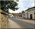
Huddersfield Road, Millbrook
The B6175 from Stalybridge to Uppermill. A First Manchester bus on the frequent 348 service from Carrbrook to Ashton is at the bus stop in front of the shops. The shops include a pet shop, the Peking fish and chip shop and the Premier supermarket which now includes the Post Office. The PO was formerly across the road Image but that shop is now a pharmacy Image On the right the former "Commercial" Image is now boarded up.
Image: © Gerald England Taken: 24 Oct 2012
0.02 miles
7
Huddersfield Road, Millbrook
Image: © Gerald England Taken: 28 Apr 2009
0.02 miles
8
The Commercial on Besom Lane, Millbrook
Image: © Ian S Taken: 10 Jun 2012
0.02 miles
9
The Commercial at Millbrook
The Commercial, a closed public house at the corner of Besom Lane and Huddersfield Road. Metal shutters have appeared at the upstairs windows and have replaced the hardboard at the downstairs windows evident in Image taken 2 weeks earlier. There is currently a picture on Google Streetview (http://goo.gl/maps/Yaxh ) dating from March 2009, which shows the pub when it was open.
Image: © David Dixon Taken: 27 Jun 2012
0.02 miles
10
The Commercial
The Commercial on Huddersfield Road, Millbrook was founded as a beerhouse in 1873. It is currently vacant and boarded up.
Image: © Gerald England Taken: 24 Oct 2012
0.03 miles
  • ...