IMAGES TAKEN NEAR TO
Mottram Road, STALYBRIDGE, SK15 2QU

Introduction

This page details the photographs taken nearby to Mottram Road, SK15 2QU by members of the Geograph project.

The Geograph project started in 2005 with the aim of publishing, organising and preserving representative images for every square kilometre of Great Britain, Ireland and the Isle of Man.

There are currently over 7.5m images from over14,400 individuals and you can help contribute to the project by visiting https://www.geograph.org.uk

Image Map


Images are licensed for reuse under creativecommons.org/licenses/by-sa/2.0
Notes
  • Clicking on the map will re-center to the selected point.
  • The higher the marker number, the further away the image location is from the centre of the postcode.

Image Listing (35 Images Found)

Images are licensed for reuse under creativecommons.org/licenses/by-sa/2.0
  • ...
Image
Details
Distance
1
Barbed Warning
Warning notice at Mottram Road Allotments Image
Image: © Gerald England Taken: 28 Jun 2009
0.04 miles
2
Mottram Road Allotments
Mind the warning: Image
Image: © Gerald England Taken: 28 Jun 2009
0.04 miles
3
Mottram Road Allotments
Image: © Gerald England Taken: 28 Jun 2009
0.04 miles
4
Rainbow over Taylor Street
Harridge Pike is behind, one of the Pennine hills which dominate views of Stalybridge. This area at the bottom of Mottram Road has older but substantial houses, making it a desirable locality.
Image: © Bill Boaden Taken: 5 Oct 2010
0.06 miles
5
Mottram Road Allotments Society
Entrance to Mottram Road Allotments.
Image: © Gerald England Taken: 28 Jun 2009
0.08 miles
6
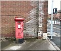
GVIR Mailbox SK15 73
Postbox at the end of Compton Street Image There used to be a post office round the corner on Mottram Road Image but no longer. Image
Image: © Gerald England Taken: 27 May 2014
0.10 miles
7
Collection information on SK15 73
Next to the normal collection time information plate on the mailbox at Compton Street Image is a smaller one that reads "Important Information: From 28th October 2007 we will no longer collect from letter boxes on Sundays or Bank Holidays."
Image: © Gerald England Taken: 27 May 2014
0.10 miles
8
Lindsay Street, Stalybridge
Seen from the junction with Stocks Lane, Raja Brothers Off Licence and Convenience Store fulfils the traditional role of the corner shop in this area of tightly packed terraced houses.
Image: © Stephen McKay Taken: 18 Feb 2020
0.10 miles
9
Stayley Ward Liberal Club
Now known as Staley House and home to insurance consultants, MG Insurance. It was built in AD 1901 according to the date stone on the front. It closed as a club in 2000.
Image: © Gerald England Taken: 27 May 2014
0.11 miles
10
Compton Street
On the left is the Stocks Inn which has sides on Compton Street, Tatton Street and Stocks Lane Image
Image: © Gerald England Taken: 27 May 2014
0.11 miles
  • ...