IMAGES TAKEN NEAR TO
Grey Street, STALYBRIDGE, SK15 2NP

Introduction

This page details the photographs taken nearby to Grey Street, SK15 2NP by members of the Geograph project.

The Geograph project started in 2005 with the aim of publishing, organising and preserving representative images for every square kilometre of Great Britain, Ireland and the Isle of Man.

There are currently over 7.5m images from over14,400 individuals and you can help contribute to the project by visiting https://www.geograph.org.uk

Image Map


Images are licensed for reuse under creativecommons.org/licenses/by-sa/2.0
Notes
  • Clicking on the map will re-center to the selected point.
  • The higher the marker number, the further away the image location is from the centre of the postcode.

Image Listing (33 Images Found)

Images are licensed for reuse under creativecommons.org/licenses/by-sa/2.0
  • ...
Image
Details
Distance
1
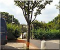
Mottram Road Allotments
Mind the warning: Image
Image: © Gerald England Taken: 28 Jun 2009
0.08 miles
2
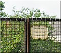
Barbed Warning
Warning notice at Mottram Road Allotments Image
Image: © Gerald England Taken: 28 Jun 2009
0.09 miles
3
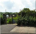
Mottram Road Allotments
Image: © Gerald England Taken: 28 Jun 2009
0.09 miles
4
Oxford Street/Stocks Lane, Stalybridge
With a First Manchester bus, No 37465 on the 12.17 348 Carrbrook to Ashton-under-Lyne via Stalybridge sunday service.
Image: © John Topping Taken: 26 May 2013
0.10 miles
5
Stocks Lane, Stalybridge
Stocks Lane leads up out of Stalybridge with more substantial houses here than further down. Wild Bank Hill forms the backdrop.
Image: © Stephen McKay Taken: 18 Feb 2020
0.10 miles
6
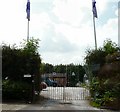
Mottram Road Allotments Society
Entrance to Mottram Road Allotments.
Image: © Gerald England Taken: 28 Jun 2009
0.10 miles
7
Hawke Street, Stalybridge
Viewed from Stocks Lane.
Image: © John Topping Taken: 26 May 2013
0.11 miles
8
Mill Street, Stalybridge
Viewed from Stocks Lane.
Image: © John Topping Taken: 26 May 2013
0.12 miles
9
Stocks Lane, Stalybridge
Red brick terraced housing on Stocks Lane, in Stalybridge, Greater Manchester, England. Such housing is typical of Stalybridge, Tameside and Greater Manchester as a whole.
Image: © Steven Haslington Taken: 19 Apr 2013
0.12 miles
10
Rainbow over Taylor Street
Harridge Pike is behind, one of the Pennine hills which dominate views of Stalybridge. This area at the bottom of Mottram Road has older but substantial houses, making it a desirable locality.
Image: © Bill Boaden Taken: 5 Oct 2010
0.12 miles
  • ...