IMAGES TAKEN NEAR TO
Stamford Close, STALYBRIDGE, SK15 1QY

Introduction

This page details the photographs taken nearby to Stamford Close, SK15 1QY by members of the Geograph project.

The Geograph project started in 2005 with the aim of publishing, organising and preserving representative images for every square kilometre of Great Britain, Ireland and the Isle of Man.

There are currently over 7.5m images from over14,400 individuals and you can help contribute to the project by visiting https://www.geograph.org.uk

Image Map


Images are licensed for reuse under creativecommons.org/licenses/by-sa/2.0
Notes
  • Clicking on the map will re-center to the selected point.
  • The higher the marker number, the further away the image location is from the centre of the postcode.

Image Listing (140 Images Found)

Images are licensed for reuse under creativecommons.org/licenses/by-sa/2.0
  • ...
Image
Details
Distance
1
Lines diverge west of Stalybridge Station
Image: © N Chadwick Taken: 27 Aug 2014
0.06 miles
2
Stamford park
Image: © David Dixon Taken: 14 Jun 2011
0.07 miles
3
Stamford Square
The A635, outside Stamford Park
Image: © David Dixon Taken: 14 Jun 2011
0.08 miles
4
Benchmark on railway bridge over Clarence Street, Stalybridge
More info at http://www.bench-marks.org.uk/bm32953
Image: © Meirion Taken: 24 Nov 2013
0.09 miles
5
Railway Bridge, Clarence St
Image: © N Chadwick Taken: 27 Aug 2014
0.09 miles
6
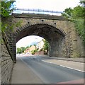
Stone railway bridge over Clarence Street
One of a pair of railway bridges Image crossing Clarence Street. This one carries the line from Stalybridge to Manchester Victoria via Ashton (Charlesworth).
Image: © Gerald England Taken: 29 Jul 2015
0.09 miles
7
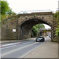
Railway bridges over Clarence Street
A pair of railway bridges cross Clarence Street. The stone bridge in the foreground Image carries the line from Stalybridge to Manchester Victoria via Ashton (Charlesworth). The flat concrete bridge beyond Image with a clearance of 4.7m / 15' 6" carries the line from Stalybridge to Manchester Piccadilly via Guide Bridge.
Image: © Gerald England Taken: 29 Jul 2015
0.09 miles
8
Stamford Park
Floral display in Stamford Park.
Image: © Gerald England Taken: 28 Jun 2009
0.09 miles
9
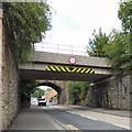
Clarence Street railway bridges
A pair of railway bridges cross Clarence Street. The flat concrete bridge in the foreground with a clearance of 4.7m / 15' 6" carries the line from Stalybridge to Manchester Piccadilly via Guide Bridge. The stone bridge beyond carries the line from Stalybridge to Manchester Victoria via Ashton (Charlesworth).
Image: © Gerald England Taken: 29 Jul 2015
0.10 miles
10
Stamford Park, The Old Market Cross
Ashton’s Market Cross used to stand in Ashton's original Market Place, at the northern corner of St Michael’s Square. This cross, dating from 1798, was the last of the crosses, replacing several earlier crosses (the market stood in St Michael’s square between 1284 and 1829 when the market moved to the present outdoor market ground). When Stamford Park was opened in 1873, the old cross was moved to its present location. See also Image
Image: © David Dixon Taken: 14 Jun 2011
0.10 miles
  • ...