IMAGES TAKEN NEAR TO
Caroline Street, STALYBRIDGE, SK15 1PD

Introduction

This page details the photographs taken nearby to Caroline Street, SK15 1PD by members of the Geograph project.

The Geograph project started in 2005 with the aim of publishing, organising and preserving representative images for every square kilometre of Great Britain, Ireland and the Isle of Man.

There are currently over 7.5m images from over14,400 individuals and you can help contribute to the project by visiting https://www.geograph.org.uk

Image Map


Images are licensed for reuse under creativecommons.org/licenses/by-sa/2.0
Notes
  • Clicking on the map will re-center to the selected point.
  • The higher the marker number, the further away the image location is from the centre of the postcode.

Image Listing (364 Images Found)

Images are licensed for reuse under creativecommons.org/licenses/by-sa/2.0
  • ...
Image
Details
Distance
1
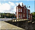
The Wharf Tavern
The Wharf Tavern public house.
Image: © Peter McDermott Taken: 26 Jun 2017
0.00 miles
2
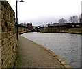
Stalybridge, towpath
On Huddersfield Narrow Canal.
Image: © Mike Faherty Taken: 26 Jan 2018
0.01 miles
3
The Wharf Tavern
On Caroline Street. Image
Image: © Gerald England Taken: 9 Sep 2009
0.01 miles
4
Huddersfield Canal Stalybridge
Part of the newly refurbished Huddersfield canal just outside Stalybridge. A long section of the canal was filled in long ago, but thanks to years of hard work by many people, it is once again fully open to boat traffic. The older building in the far centre of the picture is the Wharf Tavern.
Image: © Stephen Burton Taken: 7 Feb 2006
0.02 miles
5
Staley Wharf
On the Huddersfield Narrow Canal.
Image: © Gerald England Taken: 9 Sep 2009
0.02 miles
6
Bridge #102
Caroline Street bridge on the Huddersfield Narrow Canal.
Image: © Gerald England Taken: 9 Sep 2009
0.02 miles
7
Sign for the Wharf Tavern
Sign of the Wharf Tavern Image
Image: © Gerald England Taken: 9 Sep 2009
0.02 miles
8
Bridge 102, Huddersfield Narrow Canal
As with many canals, The Huddersfield Narrow Canal's traffic gradually dwindled through the first half of the 20th century, culminating in its official abandonment in 1944. Shortly afterwards, the stretch through Stalybridge was culverted and probably forgotten by most of the townspeople. But it was to be exhumed many years later with new bridges and locks and a steady traffic of leisure boats. This bridge, under Caroline Street, is dated 2000 and in common with other bridges through the town is illuminated - although the light fitting appears to be in desperate need of a clean. Immediately after the bridge is lock 4W.
Image: © Stephen McKay Taken: 18 Feb 2020
0.02 miles
9
Wharf Tavern and Battered Friar
On Caroline Street. The Battered Friar is a popular fish and chip shop and the Wharf Tavern has obviously expanded over the years into the adjacent properties.
Image: © Gerald England Taken: 12 May 2011
0.03 miles
10
Caroline Street Bridge, Stalybridge
Bridge 102 on the Huddersfield Narrow Canal, sporting the blue and white railings the canal in Stalybridge is famous for. The bottom gates of Lock 4W are immediately behind the bridge.
Image: © Christine Johnstone Taken: 17 May 2010
0.03 miles
  • ...