IMAGES TAKEN NEAR TO
Broadhill Road, STALYBRIDGE, SK15 1HQ
Introduction
This page details the photographs taken nearby to Broadhill Road, SK15 1HQ by members of the Geograph project.
The Geograph project started in 2005 with the aim of publishing, organising and preserving representative images for every square kilometre of Great Britain, Ireland and the Isle of Man.

There are currently over 7.5m images from over14,400 individuals and you can help contribute to the project by visiting https://www.geograph.org.uk
Image Map
Images are licensed for reuse under creativecommons.org/licenses/by-sa/2.0
Notes
- Clicking on the map will re-center to the selected point.
- The higher the marker number, the further away the image location is from the centre of the postcode.
Image Listing (6 Images Found)
Images are licensed for reuse under creativecommons.org/licenses/by-sa/2.0
Image
Details
Distance
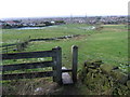
2
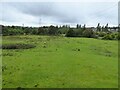
Field path from Arlies Lane
Heading towards the defined paths that lead to Stamford Park circuits
Image: © Kevin Waterhouse
Taken: 22 Sep 2023
0.12 miles
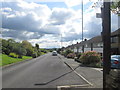
5
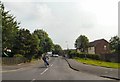
Windermere Road
On the Ridge Hill Estate.
Image: © Gerald England
Taken: 27 Jun 2009
0.21 miles
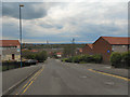
6
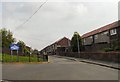
Ullswater Terrace
On the Ridge Hill Estate.
Image: © Gerald England
Taken: 27 Jun 2009
0.22 miles