IMAGES TAKEN NEAR TO
Mottram Moor, HYDE, SK14 8NB

Introduction

This page details the photographs taken nearby to Mottram Moor, SK14 8NB by members of the Geograph project.

The Geograph project started in 2005 with the aim of publishing, organising and preserving representative images for every square kilometre of Great Britain, Ireland and the Isle of Man.

There are currently over 7.5m images from over14,400 individuals and you can help contribute to the project by visiting https://www.geograph.org.uk

Image Map


Images are licensed for reuse under creativecommons.org/licenses/by-sa/2.0
Notes
  • Clicking on the map will re-center to the selected point.
  • The higher the marker number, the further away the image location is from the centre of the postcode.

Image Listing (43 Images Found)

Images are licensed for reuse under creativecommons.org/licenses/by-sa/2.0
  • ...
Image
Details
Distance
1
Approaching Hollingworth
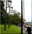
Alongside the A57 as it approaches the Gun Inn at Hollingworth.
Image: © Gerald England Taken: 6 Oct 2008
0.02 miles
2
Hollingworth War Memorial
The War Memorial near the Gun Inn.
Image: © Gerald England Taken: 6 Oct 2008
0.03 miles
3
Signpost & War Memorial
Old signpost next to the War Memorial at Hollingworth.
Image: © Gerald England Taken: 6 Oct 2008
0.04 miles
4
Milestone at Hollingworth
Near the junction of the A57 and A628. Manchester 10m, Barnsley 24m, Glossop 3m. Milestone Society National ID: CH_SK0096.
Image: © Gerald England Taken: 6 Oct 2008
0.05 miles
5
Old Direction Sign - Signpost by the A57, Hollingworth, Mossley Parish
Lantern finial - 3 arms; by the A57, in parish of Mossley (Tameside District), Hollingworth, junction of Mottram Moor and Woolley Lane, beside war memorial. To be surveyed Milestone Society National ID: CH_SK0096.
Image: © Milestone Society Taken: Unknown
0.05 miles
6
War Memorial, Hollingworth
Image: © JThomas Taken: 21 Mar 2019
0.05 miles
7
Junction
This is the junction of the A628 and A57 in Hollingworth. You turn right here for Image and straight ahead on for Image
Image: © Paul Anderson Taken: 11 Jul 2007
0.06 miles
8
The end of Woolley Lane
From the end of Mottram Moor.
Image: © David Lally Taken: 10 Nov 2010
0.07 miles
9
Gun Inn
The Gun Inn is a Grade II listed building https://historicengland.org.uk/listing/the-list/list-entry/1068062 and dates from 1781. It stands at the important junction of the A57 (Glossop, Snake Pass, Sheffield) and the A628 (Woodhead, Barnsley) roads east of Manchester.
Image: © Gerald England Taken: 6 Oct 2008
0.07 miles
10
Hollingworth Junction
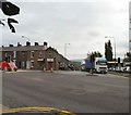
Two lorries are emerging on the A57 from Glossop turning left on to Mottram Moor. The road on the left is the A628 Woodhead Pass to Barnsley.
Image: © Gerald England Taken: 6 Oct 2008
0.07 miles
  • ...