IMAGES TAKEN NEAR TO
Chain Bar Way, HYDE, SK14 6QF

Introduction

This page details the photographs taken nearby to Chain Bar Way, SK14 6QF by members of the Geograph project.

The Geograph project started in 2005 with the aim of publishing, organising and preserving representative images for every square kilometre of Great Britain, Ireland and the Isle of Man.

There are currently over 7.5m images from over14,400 individuals and you can help contribute to the project by visiting https://www.geograph.org.uk

Image Map


Images are licensed for reuse under creativecommons.org/licenses/by-sa/2.0
Notes
  • Clicking on the map will re-center to the selected point.
  • The higher the marker number, the further away the image location is from the centre of the postcode.

Image Listing (78 Images Found)

Images are licensed for reuse under creativecommons.org/licenses/by-sa/2.0
  • ...
Image
Details
Distance
1
Chain Bar Lane
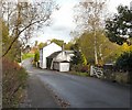
Viewed from Mill Hill Green. The white building now called the "Old Manor House" was originally the "Horseshoe" public house. http://hydonian.blogspot.com/2011/03/horseshoe-public-house.html
Image: © Gerald England Taken: 21 Oct 2010
0.06 miles
2
The Old Manor House
The "Old Manor House" on Chain Bar Lane was originally the "Horseshoe" public house. http://hydonian.blogspot.com/2011/03/horseshoe-public-house.html
Image: © Gerald England Taken: 21 Oct 2010
0.06 miles
3
Mill Hill Green off Ashworth Lane
Chain Bar Lane is below the dip. The houses in the background are on Stringer Avenue.
Image: © Gerald England Taken: 21 Oct 2010
0.07 miles
4
Chain Bar Lane
Looking past Brookfield Cottage and the Old Manor House. The "Old Manor House" was originally the "Horseshoe" public house. http://hydonian.blogspot.com/2011/03/horseshoe-public-house.html
Image: © Gerald England Taken: 21 Oct 2010
0.07 miles
5
Ashworth Lane
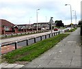
The B6174 from Hattersley to Mottram in Longdendale just after the grass verges have been cut Image
Image: © Gerald England Taken: 11 Jun 2012
0.08 miles
6
Hattersley Monkey Puzzle Tree
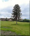
Since being moved two years ago the grass has grown around its base, but it still requires support. The houses in the background are on Green Way.
Image: © Gerald England Taken: 11 Jun 2012
0.08 miles
7
Cutting the grass
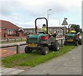
Two council grass-cutters on Ashworth Lane.
Image: © Gerald England Taken: 11 Jun 2012
0.09 miles
8
John Kennedy Road, Mottram in Longdendale
Viewed from Ashworth Lane (B6174).
Image: © John Topping Taken: 24 Oct 2013
0.09 miles
9
Hattersley Monkey Puzzle Tree
Looking rather sad in its new location off Ashworth Lane. Behind it is the works unit and lorry park for construction site of the new Tesco supermarket across the road.
Image: © Gerald England Taken: 15 Nov 2011
0.09 miles
10
Hattersley Monkey Puzzle Tree
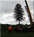
The Hattersley Monkey Puzzle Tree being lowered into its new site.
Image: © Gerald England Taken: 21 Oct 2010
0.09 miles
  • ...