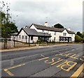
IMAGES TAKEN NEAR TO
Mottram Fold, HYDE, SK14 6PU

Introduction

This page details the photographs taken nearby to Mottram Fold, SK14 6PU by members of the Geograph project.

The Geograph project started in 2005 with the aim of publishing, organising and preserving representative images for every square kilometre of Great Britain, Ireland and the Isle of Man.

There are currently over 7.5m images from over14,400 individuals and you can help contribute to the project by visiting https://www.geograph.org.uk

Image Map


Images are licensed for reuse under creativecommons.org/licenses/by-sa/2.0
Notes
  • Clicking on the map will re-center to the selected point.
  • The higher the marker number, the further away the image location is from the centre of the postcode.

Image Listing (178 Images Found)

Images are licensed for reuse under creativecommons.org/licenses/by-sa/2.0
  • ...
Image
Details
Distance
1
Former Pack Horse Inn
The Pack Horse Inn was a stopping place for pack horse trains on the saltway from Cheshire through to Yorkshire. Having being closed for more than year, owners Enterprise Inns, based in Solihull, were granted planning permission in 2013 to convert it into a single house.
Image: © Gerald England Taken: 15 Dec 2014
0.03 miles
2
Former Pack Horse Inn
The Pack Horse Inn was a stopping place for pack horse trains on the saltway from Cheshire through to Yorkshire. Having being closed for more than year, owners Enterprise Inns, based in Solihull, were granted planning permission in 2013 to convert it into a single house. The conversion is now complete.
Image: © Gerald England Taken: 24 Jun 2017
0.03 miles
3
Market Place Mottram
Mottram in Longdendale Market Place.
Image: © Gerald England Taken: 13 Sep 2003
0.03 miles
4
Mottram Market Place
The market place at Mottram in Longdendale. The old court house is now the home of the Tameside Patrollers.
Image: © Gerald England Taken: 8 Aug 2009
0.04 miles
5
The Pack Horse
The Pack Horse on Ashworth Lane (B6174) at Mottram.
Image: © David Dixon Taken: 17 Nov 2011
0.04 miles
6
Mottram Market Place
In the background is the Pack Horse Inn on Ashworth Lane.
Image: © Gerald England Taken: 8 Aug 2009
0.04 miles
7
Mottram Market Place
Here Market Street (left) becomes Broadbottom Road. Opposite is Church Brow leading to St Michael and All Saints.
Image: © Gerald England Taken: 8 Aug 2009
0.04 miles
8
Market Place, Mottram
The busy junction of Ashworth Lane (B6174) and Broadbottom Road at Mottram Market Place. Ahead at the top of Church Brow, the Grade II* listed, fifteenth century, Mottram Parish Church St Michael & All Angels can be seen on the skyline.
Image: © David Dixon Taken: 17 Nov 2011
0.04 miles
9
Mottram Library
On Broadbottom Road.
Image: © Gerald England Taken: 27 Jan 2011
0.04 miles
10
The Pack Horse is boarded up
Yet another public house is closed and boarded
Image: © Anthony Parkes Taken: 8 Mar 2013
0.04 miles
  • ...