IMAGES TAKEN NEAR TO
Hall Close, HYDE, SK14 6LJ

Introduction

This page details the photographs taken nearby to Hall Close, SK14 6LJ by members of the Geograph project.

The Geograph project started in 2005 with the aim of publishing, organising and preserving representative images for every square kilometre of Great Britain, Ireland and the Isle of Man.

There are currently over 7.5m images from over14,400 individuals and you can help contribute to the project by visiting https://www.geograph.org.uk

Image Map


Images are licensed for reuse under creativecommons.org/licenses/by-sa/2.0
Notes
  • Clicking on the map will re-center to the selected point.
  • The higher the marker number, the further away the image location is from the centre of the postcode.

Image Listing (15 Images Found)

Images are licensed for reuse under creativecommons.org/licenses/by-sa/2.0
Image
Details
Distance
1
Mottram Old Hall
The land is used for the Mottram Show, but the hall is separately owned.
Image: © Bill Boaden Taken: 14 Dec 2009
0.10 miles
2
Mottram Old Hall
A view of the rear of the hall, taken from the public footpath and bridleway which leads out over Hobson Moor
Image: © Roger May Taken: 4 Aug 2005
0.10 miles
3
Rabbit Lane
Lane at the side of Mottram Old Hall.
Image: © David Dixon Taken: 19 Nov 2011
0.10 miles
4
Converted Gatehouse at the end of Hall Drive
Image: © Anthony Parkes Taken: 29 Dec 2011
0.12 miles
5
Path Behind Mottram Old Hall
Image: © David Dixon Taken: 19 Nov 2011
0.12 miles
6
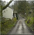
Rabbit Lane
Image: © Gerald England Taken: 15 Apr 2008
0.12 miles
7
Coach Road
Track from Mottram Old Hall to Vale Farm.
Image: © David Dixon Taken: 19 Nov 2011
0.14 miles
8
Old Direction Sign - Signpost by the A6018, Roe Cross Road
No finial - 1 arm; by the A6018, in parish of Longdendale (Tameside District), Mottram, junction of Roe Cross Road and Stalybridge Road, on front wall of house next to first floor window. Surveyed Milestone Society National ID: CH_SJ9995F.
Image: © Milestone Society Taken: Unknown
0.20 miles
9
Old Direction Sign - Signpost by the A6018, Back Moor, Mottram in Longdendale
Pawn finial - 2 arms; by the A6018, in parish of Longdendale (Tameside District), Mottram, junction of Stalybridge Road with Back Moor, on kerb beside roundabout. Surveyed Milestone Society National ID: CH_SJ9995B
Image: © Milestone Society Taken: Unknown
0.21 miles
10
Old Direction Sign - Signpost by the A6018, Mottram in Longdendale
No finial - 2 arms; attached to stone wall by the A6018, in parish of Longdendale (Tameside District), Mottram, junction of Stalybridge Road with Back Moor, on stone wall behind free standing fingerpost: CH_SJ9995B Image Surveyed Milestone Society National ID: CH_SJ9995C
Image: © Milestone Society Taken: Unknown
0.21 miles