IMAGES TAKEN NEAR TO
Ogden Street, HYDE, SK14 6AD

Introduction

This page details the photographs taken nearby to Ogden Street, SK14 6AD by members of the Geograph project.

The Geograph project started in 2005 with the aim of publishing, organising and preserving representative images for every square kilometre of Great Britain, Ireland and the Isle of Man.

There are currently over 7.5m images from over14,400 individuals and you can help contribute to the project by visiting https://www.geograph.org.uk

Image Map


Images are licensed for reuse under creativecommons.org/licenses/by-sa/2.0
Notes
  • Clicking on the map will re-center to the selected point.
  • The higher the marker number, the further away the image location is from the centre of the postcode.

Image Listing (136 Images Found)

Images are licensed for reuse under creativecommons.org/licenses/by-sa/2.0
  • ...
Image
Details
Distance
1
Broadbottom Methodist Church
The Methodist Church on Ogden Street was built in 1920.
Image: © Gerald England Taken: 30 Jun 2010
0.01 miles
2
View of River Etherow Valley
The view is from train entering Broadbottom station. The large building showing above the trees is a converted Chapel
Image: © Raymond Knapman Taken: 24 Jun 2011
0.01 miles
3
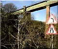
Broadbottom Viaduct
The viaduct carrying the railway from Manchester to Glossop sweeps high above the road bridge crossing the River Etherow which forms the boundary between Derbyshire and what used to be Cheshire.
Image: © Gerald England Taken: 17 Nov 2009
0.02 miles
4
Viaduct support
One of the supports for the Broadbottom viaduct in the River Etherow, viewed from the footbridge.
Image: © Gerald England Taken: 1 Aug 2008
0.03 miles
5
Cheshire Cheese
Public house on Lower Market Street in Broadbottom village.
Image: © David Dixon Taken: 17 Nov 2011
0.03 miles
6
Etherow Viaduct from Above
Also known as Broadbottom Viaduct. Crosses a gorge formed by the River Etherow on the Greater Manchester/Derbyshire border just to the east of Broadbottom. It carries the Manchester/Glossop Line. Originally a wooden structure supported by 3 arches, the viaduct morphed into the green metal span by 1919 as trains became heavier. 137 feet at its highest point and 169 yards long. A similar but larger structure at Dinting near Glossop, on the same line can be seen.
Image: © Chris Heaton Taken: 9 Dec 2015
0.03 miles
7
Lower Market Street
Outside one of the houses is an entry for the annual scarecrow competition.
Image: © Gerald England Taken: 30 Jun 2010
0.03 miles
8
Cheshire Cheese
The Cheshire Cheese on Lower Market Street, Broadbottom. Image
Image: © Gerald England Taken: 30 Jun 2010
0.03 miles
9
Sign for the Cheshire Cheese
The sign of the Cheshire Cheese in Broadbottom Image
Image: © Gerald England Taken: 30 Jun 2010
0.03 miles
10
Broadbottom Bridges
River meets rail and road. Manchester-Glossop rail line and Broadbottom-Charlesworth road cross the River Etherow.
Image: © Stephen Burton Taken: 26 Jul 2004
0.03 miles
  • ...