IMAGES TAKEN NEAR TO
Aspland Road, HYDE, SK14 5LS

Introduction

This page details the photographs taken nearby to Aspland Road, SK14 5LS by members of the Geograph project.

The Geograph project started in 2005 with the aim of publishing, organising and preserving representative images for every square kilometre of Great Britain, Ireland and the Isle of Man.

There are currently over 7.5m images from over14,400 individuals and you can help contribute to the project by visiting https://www.geograph.org.uk

Image Map


Images are licensed for reuse under creativecommons.org/licenses/by-sa/2.0
Notes
  • Clicking on the map will re-center to the selected point.
  • The higher the marker number, the further away the image location is from the centre of the postcode.

Image Listing (255 Images Found)

Images are licensed for reuse under creativecommons.org/licenses/by-sa/2.0
  • ...
Image
Details
Distance
1
Only a footpath
The footpath from Werneth Low down to Gee Cross Village. A sign on the gate forbids horseriders to pass through. The red box is for the use of dog-walkers!
Image: © Gerald England Taken: 20 Jul 2008
0.03 miles
2
View over Gee Cross
View from Aspland Road. Holy Trinity church is visible in the right foreground. In mid-background is Audenshaw reservoirs and beyond that can be seen the City of Manchester Stadium.
Image: © Gerald England Taken: 25 May 2003
0.05 miles
3
Entrance to Lower Higham Visitor Centre
Lane leading off Higham Lane to the Visitor Centre.
Image: © Gerald England Taken: 10 Feb 2008
0.05 miles
4
Post by the entrance to Werneth Low Visitor Centre
Post by the entrance off Higham Lane. Originally this was a gate post which closed off the entrance to the approach to the Hacking Knife fields (side route up to the cenotaph) and there was a second set which closed off Lower Higham Farm (now the Visitor Centre). With the first gate open cattle could then be driven up and when shut could be driven down without entering the farm yard. My thanks to Steve Pearson for this information.
Image: © Gerald England Taken: 10 Feb 2008
0.07 miles
5
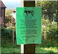
Signpost with notice
Attached to the signpost in Werneth Country Park is a notice about cattle grazing in the fields. Image
Image: © Gerald England Taken: 21 Sep 2008
0.08 miles
6
Notice from the Country Park Warden
The notice on a signpost Image reads: DEAR VISITORS PLEASE NOTE THAT FROM AUGUST 2008 CATTLE WILL BE IN THE FIELDS AND MEADOWS OF THE COUNTRY PARK. THIS IS IMPORTANT LAND MANAGEMENT WHICH WILL SUSTAIN THE FLOWER RICH FIELDS WERNETH LOW IS FAMOUS FOR. I EXPECT CATTLE TO BE HERE UP TO NOVEMBER 2008 WEATHER PERMITTING. I WOULD APPRECIATE YOUR CO-OPERATION DURING THIS PERIOD BY NOT ALLOWING YOUR DOG TO CHASE CATTLE, KEEPING YOUR DOG UNDER CLOSE CONTROL AT ALL TIMES.
Image: © Gerald England Taken: 21 Sep 2008
0.08 miles
7
Lower Higham Visitor Centre, Werneth Low Country Park
Image: © David Dixon Taken: 22 Oct 2011
0.08 miles
8
Springs Avenue
Between Higham Lane and Mottram Old Road, Gee Cross.
Image: © Gerald England Taken: 20 Jul 2008
0.08 miles
9
Gower Hey Woods
A wooded area just above Gee Cross Village.
Image: © Gerald England Taken: 15 Jun 2008
0.08 miles
10
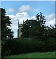
Holy Trinity Tower
The tower of Holy Trinity from the footpath below Aspland Road.
Image: © Gerald England Taken: 16 Jul 2007
0.08 miles
  • ...