IMAGES TAKEN NEAR TO
Armitage Close, HYDE, SK14 5JL

Introduction

This page details the photographs taken nearby to Armitage Close, SK14 5JL by members of the Geograph project.

The Geograph project started in 2005 with the aim of publishing, organising and preserving representative images for every square kilometre of Great Britain, Ireland and the Isle of Man.

There are currently over 7.5m images from over14,400 individuals and you can help contribute to the project by visiting https://www.geograph.org.uk

Image Map


Images are licensed for reuse under creativecommons.org/licenses/by-sa/2.0
Notes
  • Clicking on the map will re-center to the selected point.
  • The higher the marker number, the further away the image location is from the centre of the postcode.

Image Listing (829 Images Found)

Images are licensed for reuse under creativecommons.org/licenses/by-sa/2.0
  • ...
Image
Details
Distance
1
Dowson Trail
Entrance from Armitage Close on to the Dowson Trail. A permissive path around Dowson Primary School leading to Gower Hey Woods and the Trans Pennine Trail.
Image: © Gerald England Taken: 14 Jun 2015
0.02 miles
2
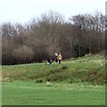
Gower Hey
Common land just outside Gower Hey Wood.
Image: © Gerald England Taken: Unknown
0.02 miles
3
Gower Hey
Common land between Gower Hey Wood and Dowson Primary School. Compare with the scene in 2000 Image
Image: © Gerald England Taken: 14 Jun 2009
0.04 miles
4
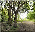
Christmas Day dog walkers
On one of the permissive paths between Dowson School playing fields and Gower Hey Woods. It looks as if there is a squirrel's dray in one of the trees.
Image: © Gerald England Taken: 25 Dec 2017
0.05 miles
5
York Road
From Dowson Primary School to King Edward Avenue.
Image: © Gerald England Taken: 11 Jul 2010
0.07 miles
6
Gee Cross
The spire of Hyde Chapel viewed from Gower Hey Wood.
Image: © Gerald England Taken: Unknown
0.08 miles
7
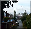
Acorn Avenue
Looking down Acorn Avenue towards Hyde Chapel.
Image: © Gerald England Taken: 17 Mar 2009
0.09 miles
8
Dowson Primary Playing Fields
The paths around the fields are permissive footpaths.
Image: © Gerald England Taken: 25 Dec 2018
0.09 miles
9
Land cleared for housing
Viewed from Stockport Road is land accessed from King Edward Road. It used to contain some light industrial units including a joinery workshop. These were demolished some years ago. In recent months the retaining wall on Stockport Road was strengthened. Now the site has been cleared and houses are to be built thereon.
Image: © Gerald England Taken: 15 Apr 2017
0.09 miles
10
Gower Hey Wood
Image: © Gerald England Taken: 14 Jun 2009
0.09 miles
  • ...