IMAGES TAKEN NEAR TO
White Terrace, HYDE, SK14 5DR

Introduction

This page details the photographs taken nearby to White Terrace, SK14 5DR by members of the Geograph project.

The Geograph project started in 2005 with the aim of publishing, organising and preserving representative images for every square kilometre of Great Britain, Ireland and the Isle of Man.

There are currently over 7.5m images from over14,400 individuals and you can help contribute to the project by visiting https://www.geograph.org.uk

Image Map


Images are licensed for reuse under creativecommons.org/licenses/by-sa/2.0
Notes
  • Clicking on the map will re-center to the selected point.
  • The higher the marker number, the further away the image location is from the centre of the postcode.

Image Listing (135 Images Found)

Images are licensed for reuse under creativecommons.org/licenses/by-sa/2.0
  • ...
Image
Details
Distance
1
The Bottom of Apethorn
This track at the bottom of Apethorn Lane leads out of the car park opposite the site of Gee Cross Mill. To the left, the track leads through a tunnel under the Peak Forest Canal to Gibraltar Row. To the right it leads under the main Hyde to Woodley railway line towards the Trans Pennine Trail along the former Godley to Apethorn railway line.
Image: © Gerald England Taken: 24 Apr 2010
0.02 miles
2
Track to Gibraltar Row
Track from the bottom end of Apethorn Road leading towards a tunnel under the Peak Forest Canal.
Image: © Gerald England Taken: 24 Apr 2010
0.02 miles
3
Gate on Apethorn Lane
The gate leads into the grounds of the house that was built on the site of the former Gee X mill.
Image: © Gerald England Taken: 30 Sep 2016
0.02 miles
4
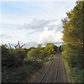
Railway lines to Hyde
The railway to Hyde and Manchester from Apethorn Lane.
Image: © Gerald England Taken: 1 Jun 2014
0.03 miles
5
Bridge RYH 2/17
Carrying Apethorn Lane over the Rose Hill (Marple) to Manchester (Piccadilly) railway line.
Image: © Gerald England Taken: 30 Sep 2016
0.03 miles
6
Railway lines towards Hyde
From the Apethorn Lane bridge. The route is the one from Rose Hill (Marple) to Manchester (Piccadilly). Just past the 60 sign the line passes over the Trans Pennine Trail.
Image: © Gerald England Taken: 30 Sep 2016
0.04 miles
7
Site of Gee Cross Mill
The gardens of the large houses at the bottom of Apethorn Lane next to the Peak Forest Canal are on the site of the former Gee Cross Mill (aka Apethorn Mill).
Image: © Gerald England Taken: 24 Apr 2010
0.04 miles
8
Railway bridge near Thistley Fields
Bridge under the railway line from Manchester Piccadilly via Hyde Central to Woodley and Rose Hill (Marple).
Image: © Gerald England Taken: 21 Apr 2013
0.04 miles
9
Railway bridge near Apethorn Lane
Bridge under the railway line from Manchester Piccadilly via Hyde Central to Woodley and Rose Hill (Marple). On the other side of the bridge a footpath to the left leads to Thistley Fields while the path ahead leads to Apethorn Lane and the Trans Pennine Trail along the former Godley Junction to Apethorn Railway line. This side of the bridge, the path to the right leads to a car park at the bottom of Apethorn Lane and a footbridge over the Peak Forest Canal whilst the one behind us leads to a tunnel under the canal.
Image: © Gerald England Taken: 21 Apr 2013
0.04 miles
10
Bottom of Apethorn Lane
Looking from the towpath of the Peak Forest Canal. To the left of the lane is a small car park. The landscaped lawns visible on the right under Apethorn footbridge (bridge 8a) belong to a private property built on the site of the former Gee X mill.
Image: © Gerald England Taken: 21 Apr 2013
0.04 miles
  • ...