IMAGES TAKEN NEAR TO
Barton Fold, HYDE, SK14 5BG

Introduction

This page details the photographs taken nearby to Barton Fold, SK14 5BG by members of the Geograph project.

The Geograph project started in 2005 with the aim of publishing, organising and preserving representative images for every square kilometre of Great Britain, Ireland and the Isle of Man.

There are currently over 7.5m images from over14,400 individuals and you can help contribute to the project by visiting https://www.geograph.org.uk

Image Map


Images are licensed for reuse under creativecommons.org/licenses/by-sa/2.0
Notes
  • Clicking on the map will re-center to the selected point.
  • The higher the marker number, the further away the image location is from the centre of the postcode.

Image Listing (411 Images Found)

Images are licensed for reuse under creativecommons.org/licenses/by-sa/2.0
  • ...
Image
Details
Distance
1
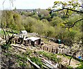
Woodend Allotments
Looking from the allotments on Woodend Street, over Gower Hey Wood towards Clough Fold.
Image: © Gerald England Taken: 8 Sep 2007
0.03 miles
2
Woodend Allotments
An allotment on the slope of the Gower Hey Valley below Woodend Lane. A century ago there were a great many allotments on both sides of the valley. http://oldhyde.blogspot.com/2010/05/church-brow-gardens-repost.html Recently the smaller plots at the top of the valley nearest Woodend Lane have been abandoned, mainly due to the cost of vandalism.
Image: © Gerald England Taken: 10 Apr 2011
0.04 miles
3
Woodend Goose
Livestock on one of the allotments at Woodend.
Image: © Gerald England Taken: 10 Apr 2011
0.04 miles
4
Footpath to Church Brow
Footpath by Clough Fold Farm leading from Grosvenor Crescent to Church Brow.
Image: © Gerald England Taken: 24 Apr 2010
0.05 miles
5
Fenced-in footpath
Now a narrow footpath between the fences of back gardens either side, this was an ancient route from Foxholes to Hyde. Note the old tree roots and the stone setts.
Image: © Gerald England Taken: 3 May 2012
0.05 miles
6
Clough Fold
Footpath to Church Brow.
Image: © Gerald England Taken: 24 Apr 2010
0.05 miles
7
Woodend Allotments
Although some allotments on the lower slopes of the valley of the Gower Hey Brook are still used and maintained, those on the upper slopes by Woodend Lane have been mainly abandoned.
Image: © Gerald England Taken: 23 Mar 2012
0.05 miles
8
Clough Fold
Footbridge over the brook in Clough Fold.
Image: © Gerald England Taken: 24 Apr 2010
0.06 miles
9
Clough Fold
Footpath leading from Church Brow towards the Peak Forest Canal.
Image: © Gerald England Taken: 24 Apr 2010
0.06 miles
10
Clough Fold Road
At the junction with the footpath to Gower Road and Church Brow.
Image: © Gerald England Taken: 24 Apr 2010
0.06 miles
  • ...