IMAGES TAKEN NEAR TO
Peak Place, HYDE, SK14 4WG

Introduction

This page details the photographs taken nearby to Peak Place, SK14 4WG by members of the Geograph project.

The Geograph project started in 2005 with the aim of publishing, organising and preserving representative images for every square kilometre of Great Britain, Ireland and the Isle of Man.

There are currently over 7.5m images from over14,400 individuals and you can help contribute to the project by visiting https://www.geograph.org.uk

Image Map


Images are licensed for reuse under creativecommons.org/licenses/by-sa/2.0
Notes
  • Clicking on the map will re-center to the selected point.
  • The higher the marker number, the further away the image location is from the centre of the postcode.

Image Listing (94 Images Found)

Images are licensed for reuse under creativecommons.org/licenses/by-sa/2.0
  • ...
Image
Details
Distance
1
Lines to Hyde
The railway line from Manchester to Rose Hill (Marple) viewed from Bennett Street bridge. The houses on the left are part of a development called "The Parks" built on the land previously occupied by Castrol Oil.
Image: © Gerald England Taken: 13 Apr 2016
0.05 miles
2
Peak Place
Footpath from Bennett Street leading to new houses on Peak Place.
Image: © Gerald England Taken: 16 Sep 2023
0.07 miles
3
Bennett Street
At the end of Bennett Street, Newton, the road crosses the railway line to become Lower Bennett Street.
Image: © Gerald England Taken: 3 Oct 2008
0.07 miles
4
Morris Homes Marketing Suite
Sales office for "The Parks" development of new houses on the land formerly the Castrol Oil works.
Image: © Gerald England Taken: 13 Apr 2016
0.08 miles
5
Bennett Street
In front of St Stephen's church which is due to be converted into housing is the market suite Image for "The Parks", a quite separate development on the former Castrol Oil works site.
Image: © Gerald England Taken: 13 Apr 2016
0.08 miles
6
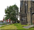
St Stephen's churchyard
Although the rear of churchyard has been allowed to go wild since the church closed a year ago, someone is mowing the side lawn and keeping it trim.
Image: © Gerald England Taken: 21 Jul 2012
0.09 miles
7
Arnside Drive
Off Lower Bennett Street.
Image: © Gerald England Taken: 21 Jul 2012
0.09 miles
8
St Stephen's Church
The south-western aspect.
Image: © Gerald England Taken: 3 Oct 2008
0.09 miles
9
St Stephen's Church
The southwest aspect of the church.
Image: © Gerald England Taken: 13 Apr 2016
0.09 miles
10
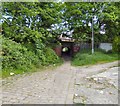
The Little Tunnel
A short tunnel under the Rose Hill to Manchester railway line connects Arnside Drive to Furnace Street.
Image: © Gerald England Taken: 29 May 2016
0.09 miles
  • ...