IMAGES TAKEN NEAR TO
Coniston Avenue, HYDE, SK14 4PG

Introduction

This page details the photographs taken nearby to Coniston Avenue, SK14 4PG by members of the Geograph project.

The Geograph project started in 2005 with the aim of publishing, organising and preserving representative images for every square kilometre of Great Britain, Ireland and the Isle of Man.

There are currently over 7.5m images from over14,400 individuals and you can help contribute to the project by visiting https://www.geograph.org.uk

Image Map


Images are licensed for reuse under creativecommons.org/licenses/by-sa/2.0
Notes
  • Clicking on the map will re-center to the selected point.
  • The higher the marker number, the further away the image location is from the centre of the postcode.

Image Listing (198 Images Found)

Images are licensed for reuse under creativecommons.org/licenses/by-sa/2.0
  • ...
Image
Details
Distance
1
Star Kitchen
Chinese takeaway on Dukinfield Road.
Image: © Gerald England Taken: 19 May 2014
0.04 miles
2
Dukinfield Road
The A627 from Hyde to Ashton under Lyne.
Image: © Gerald England Taken: 26 Feb 2011
0.04 miles
3
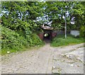
The Little Tunnel
Connecting Furnace Street and Arnside Drive under the Manchester to Rose Hill railway.
Image: © Gerald England Taken: 29 May 2016
0.04 miles
4
The Little Tunnel
A short tunnel under the Rose Hill to Manchester railway line connects Arnside Drive to Furnace Street.
Image: © Gerald England Taken: 29 May 2016
0.04 miles
5
Dukinfield Road
The A627 from Hyde to Ashton under Lyne near Throstle Bank Street.
Image: © Gerald England Taken: 19 May 2014
0.07 miles
6
Demolished works
Image: © Alex McGregor Taken: 20 Jun 2013
0.07 miles
7
Throstle Bank Street
A piece of public art at the corner of Throstle Bank Street and Dukinfield Road. It may be a sundial but there are no numbers marked anywhere.
Image: © Gerald England Taken: 26 Feb 2011
0.08 miles
8
Is it a Sundial?
A piece of public art at the corner of Throstle Bank Street and Dukinfield Road. It may be a sundial but there are no numbers marked anywhere. It may be some sort of memorial to Shenton's Foundry which stood in Shenton Street - 1st on the left off Throstle Bank Street. http://spadsky-hydedailyphoto.blogspot.com/2011/03/public-art-on-throstle-bank-street.html
Image: © Gerald England Taken: 26 Feb 2011
0.08 miles
9
Furnace Street
An 8 acre brownfield development site. The Alma Works on Furnace Street was formerly used by Burmah Castrol for the processing and storage of oils. The site ceased operation in 2007 and formally closed in 2009. Now like similar sites it is being filled with housing.
Image: © Gerald England Taken: 29 May 2016
0.08 miles
10
Throstle Bank Villas
On the corner of Dukinfield Road and Throstle Bank Street. Built in 1880.
Image: © Gerald England Taken: 26 Feb 2011
0.08 miles
  • ...