1
Hattersley Crossroads
The A560 divides the Hattersley Estate into two unequal parts. This is the main intersection between the two parts of the estate.
Image: © Roger May
Taken: 14 Aug 2005
0.02 miles
2
Stockport Road, Hattersley
The A560 from Stockport towards the A57 and end of the M67 at Mottram from the junction with Underwood Road, Hattersley. On the right a Tesco Extra store is under construction on land formerly used for housing.
Image: © Gerald England
Taken: 11 Jun 2012
0.04 miles
3
Stockport Road, Hattersley
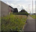
The A560 at Hattersley from the junction with Ashworth Lane. The council demolished all the houses on the east side of Stockport in the mid-noughties. However one owner resisted all offers to purchase and remains. Wildflowers grow on the former garden of the adjacent boarded-up house.
Image: © Gerald England
Taken: 19 Jun 2014
0.04 miles
4
Hattersley Crossroads
Looking across the A560 to Stockport from the corner with Ashworth Lane towards the corner with Underwood Lane. The bus at the crossroads is a #201 from Manchester which will terminate on John Kennedy Road.
Image: © Gerald England
Taken: 25 Jul 2012
0.05 miles
5
Across Stockport Road
Looking across Stockport Road to the site of the Tesco supermarket currently under construction. In the background is St Michael and All Angels church at Mottram. Not in view is the Monkey Puzzle tree (see view in 2008
Image) now moved to a site off Ashworth Lane
Image
Image: © Gerald England
Taken: 15 Nov 2011
0.06 miles
6
Building work at Hattersley
Looking across the junction from Underwood Road over the A560 towards Ashworth Lane. The buildings under construction are part of the Tesco Xtra site. I understand that these will be "community buildings" provided by Tescos as a "sweetener" for being allowed to build on former residential land.
Image: © Gerald England
Taken: 11 Jun 2012
0.06 miles
7
Hattersley Community Hub
The new district 'hub' on Ashworth Lane.
When fully operational, the new facility will physically house the library service, Hattersley Neighbourhood partnership, the police, the community association and Peak Valley Housing Association as well as numerous other community groups (press release).
Image: © David Dixon
Taken: 23 Nov 2012
0.06 miles
8
Chain Bar Lane
Looking across Ashworth Lane to the area of Hattersley known as Chain Bar Lane. This was once full of houses, part of the Manchester Overspill Housing built in the 1950s. Several years ago as part of the Hattersley Estate Renewal program they were all demolished with the exception of one house on Shelmardine Close (which had been purchased by the sitting tenant who refused the offer of a buyout) and the boarded up houses either side. The site is being used now as a works area for the construction of the Tesco Extra supermarket on the opposite side of Ashworth Lane (behind the photographer).
Image: © Gerald England
Taken: 11 Jun 2012
0.06 miles
9
Ashworth Lane
Looking up Ashworth Lane, the B6174 towards the crossroads with the A560. The area on the left off Chain Bar Road was once full of houses, part of the Manchester Overspill Housing built in the 1950s. Several years ago as part of the Hattersley Estate Renewal program they were all demolished with the exception of one house on Shelmardine Close (which had been purchased by the sitting tenant who refused the offer of a buyout) and the boarded up houses either side. The site is being used now as a works area for the construction of the Tesco Extra supermarket on the opposite side of Ashworth Lane (behind the photographer).
Image: © Gerald England
Taken: 11 Jun 2012
0.06 miles
10
Underwood Road, Hattersley
Viewed from the junction with Melandra Crescent (L).
Image: © John Topping
Taken: 24 Oct 2013
0.07 miles


