IMAGES TAKEN NEAR TO
Silverton Close, HYDE, SK14 3DG
Introduction
This page details the photographs taken nearby to Silverton Close, SK14 3DG by members of the Geograph project.
The Geograph project started in 2005 with the aim of publishing, organising and preserving representative images for every square kilometre of Great Britain, Ireland and the Isle of Man.

There are currently over 7.5m images from over14,400 individuals and you can help contribute to the project by visiting https://www.geograph.org.uk
Image Map
Images are licensed for reuse under creativecommons.org/licenses/by-sa/2.0
Notes
- Clicking on the map will re-center to the selected point.
- The higher the marker number, the further away the image location is from the centre of the postcode.
Image Listing (41 Images Found)
Images are licensed for reuse under creativecommons.org/licenses/by-sa/2.0
Image
Details
Distance
1
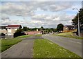
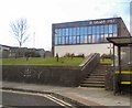
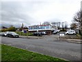
Underwood Road
Looking West from near Silverton Close.
Image: © Gerald England
Taken: 6 Jun 2011
0.05 miles
2
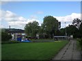
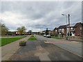
Bus stops on Hattersley Road West
Outside St Barnabas Church.
Image: © Gerald England
Taken: 2 Aug 2019
0.11 miles
3
Hattersley Road East
On the left Tameside Court Image which was the last of the tower blocks on the Hattersley estate to be built in the 1970s is finally being demolished.
Image: © Gerald England
Taken: 30 Mar 2017
0.11 miles
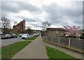
4
Hattersley Road East
On the left is St Barnabas Church Image and beyond that the remnants of Tameside Court Image the last of the tower blocks on the Hattersley estate now undergoing demolition.
Image: © Gerald England
Taken: 30 Mar 2017
0.11 miles
5
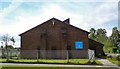
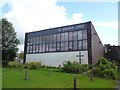
St Barnabas
St Barnabas is the Anglican church serving Hattersley. It was built in 1965 and has served residents from when it was first opened in October 1966. Before that the residents had worshipped in homes from the very first weekend of moving into Hattersley. The church building was renewed following storm damage in January 2005. It is in an Interregnum since the retirement of the Vicar Rev Derek Akker due to ill health in January 2009.
Image: © Gerald England
Taken: 27 Jan 2011
0.11 miles
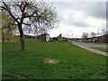
6
Underwood Road
Hattersley Road East is on the left.
Image: © Gerald England
Taken: 30 Mar 2017
0.12 miles
7
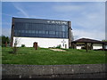
St James the Great
Roman Catholic church on Underwood Road, Hattersley.
Image: © Gerald England
Taken: 6 Jun 2011
0.12 miles
10
St Barnabas Church
St Barnabas is the Anglican church serving Hattersley. It was built in 1965 and has served residents from when it was first opened in October 1966. Before that the residents had worshipped in homes from the very first weekend of moving into Hattersley. The church building was renewed following storm damage in January 2005.
Image: © Gerald England
Taken: 2 Aug 2019
0.13 miles