IMAGES TAKEN NEAR TO
Longlands Drive, HYDE, SK14 3AX

Introduction

This page details the photographs taken nearby to Longlands Drive, SK14 3AX by members of the Geograph project.

The Geograph project started in 2005 with the aim of publishing, organising and preserving representative images for every square kilometre of Great Britain, Ireland and the Isle of Man.

There are currently over 7.5m images from over14,400 individuals and you can help contribute to the project by visiting https://www.geograph.org.uk

Image Map


Images are licensed for reuse under creativecommons.org/licenses/by-sa/2.0
Notes
  • Clicking on the map will re-center to the selected point.
  • The higher the marker number, the further away the image location is from the centre of the postcode.

Image Listing (123 Images Found)

Images are licensed for reuse under creativecommons.org/licenses/by-sa/2.0
  • ...
Image
Details
Distance
1
Residential development off Mottram Road, Hyde
Now known as Longlands Drive.
Image: © Bill Boaden Taken: 18 May 2010
0.02 miles
2
Waterworks Lane (detail)
The sign at the bottom of Image] (and Image]). The road is marked on the map as "Barmhouse Lane", but the signs say "Waterworks Lane" and "Tetlowfold". I believe that Tetlowfold Lane its original name, but have not found any reference to "Waterworks Lane" which presumably refers to the reservoir at the top of the lane.
Image: © David Dixon Taken: 19 Nov 2011
0.02 miles
3
Waterworks Lane
Although shown on the map as "Barmhouse Lane", the sign at the bottom of this road to Godley Reservoir says "Waterworks Lane" (Image]).
Image: © David Dixon Taken: 19 Nov 2011
0.03 miles
4
Barmhouse Lane
The lane is shared with heavy goods vehicles going to the Godley Water Treatment Plant and horse-riders accessing the bridlepaths in the area.
Image: © Gerald England Taken: 7 Nov 2008
0.05 miles
5
Barmhouse (Waterworks Lane)
Although this road to Godley Reservoir is shown on the map as "Barmhouse Lane", the sign at the bottom of the lane, where it meets Mottram Road, says "Waterworks Lane" (Image]).
Image: © David Dixon Taken: 19 Nov 2011
0.07 miles
6
Godley Reservoir
The South-East corner of Godley Reservoir from Barmhouse Lane.
Image: © Gerald England Taken: 7 Nov 2008
0.10 miles
7
Godley Reservoir
The South side of Godley Reservoir from Barmhouse Lane.
Image: © Gerald England Taken: 7 Nov 2008
0.11 miles
8
Kerry Foods plant from the air
Located on Kerry Way, Godley Hill. See also Image
Image: © Thomas Nugent Taken: 19 Oct 2018
0.12 miles
9
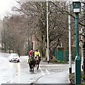
Two horses on Mottram Road
Passing the end of Godley Hill Road.
Image: © Gerald England Taken: 22 Mar 2014
0.12 miles
10
Mottram Road
The A57 which is now bypassed for non-local traffic by the M67. On the right is Godley Hill Road which was the only way for high vehicles to access the Kerry Foods factory until a new road was built in 2014. Now it just leads to a few houses and the War Memorial.
Image: © Gerald England Taken: 7 Feb 2020
0.13 miles
  • ...