IMAGES TAKEN NEAR TO
Werneth Low Road, HYDE, SK14 3AF
Introduction
This page details the photographs taken nearby to Werneth Low Road, SK14 3AF by members of the Geograph project.
The Geograph project started in 2005 with the aim of publishing, organising and preserving representative images for every square kilometre of Great Britain, Ireland and the Isle of Man.

There are currently over 7.5m images from over14,400 individuals and you can help contribute to the project by visiting https://www.geograph.org.uk
Image Map
Images are licensed for reuse under creativecommons.org/licenses/by-sa/2.0
Notes
- Clicking on the map will re-center to the selected point.
- The higher the marker number, the further away the image location is from the centre of the postcode.
Image Listing (52 Images Found)
Images are licensed for reuse under creativecommons.org/licenses/by-sa/2.0
Image
Details
Distance
1
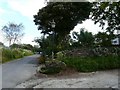
Furness Field
Werneth Low Road at Furness Field.
Image: © Gerald England
Taken: 21 Sep 2008
0.01 miles
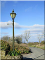
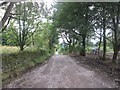
2
Uplands Road
The track/path towards Compstall.
Image: © David Dixon
Taken: 16 Nov 2012
0.04 miles
4
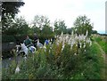
Furness Field
A bank full of rosebay willowherb separates the footpath from Werneth Low Road.
Image: © Gerald England
Taken: 21 Sep 2008
0.04 miles
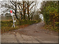
5
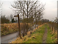
Path at the side of Werneth Low Road
The signpost is pointing towards Uplands Road and the path towards Compstall.
Image: © David Dixon
Taken: 16 Nov 2012
0.04 miles
7
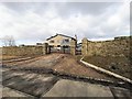
Fairview nears completion by Werneth Low
Amongst the fairways of Werneth Low Golf Club
Image: © Chris Morgan
Taken: 5 Mar 2019
0.05 miles
8
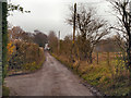
Uplands Road
Looking uphill, towards Werneth Low Road
Image: © David Dixon
Taken: 16 Nov 2012
0.07 miles
9
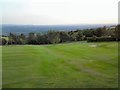
Werneth Low Golf Course
Looking SW from the Clubhouse.
Image: © Gerald England
Taken: 2 Sep 2010
0.07 miles
10
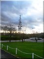
Telecoms Tower at Werneth Low Golf Club
Image: © Anthony Parkes
Taken: 28 Dec 2011
0.08 miles