IMAGES TAKEN NEAR TO
Walker Fold, HYDE, SK14 2SF

Introduction

This page details the photographs taken nearby to Walker Fold, SK14 2SF by members of the Geograph project.

The Geograph project started in 2005 with the aim of publishing, organising and preserving representative images for every square kilometre of Great Britain, Ireland and the Isle of Man.

There are currently over 7.5m images from over14,400 individuals and you can help contribute to the project by visiting https://www.geograph.org.uk

Image Map


Images are licensed for reuse under creativecommons.org/licenses/by-sa/2.0
Notes
  • Clicking on the map will re-center to the selected point.
  • The higher the marker number, the further away the image location is from the centre of the postcode.

Image Listing (226 Images Found)

Images are licensed for reuse under creativecommons.org/licenses/by-sa/2.0
  • ...
Image
Details
Distance
1
Access to Trans Pennine Trail from Walkers Fold
The cobbled path past the squeeze stile leads down to the Trans Pennine Trail Image
Image: © Gerald England Taken: 21 Feb 2015
0.02 miles
2
Grange Road North
The "New Roundabout Ahead" has been there for more than a decade now. It is at the junction with Walker Lane.
Image: © Gerald England Taken: 2 May 2020
0.04 miles
3
Rufford Avenue
Off Walker Fold.
Image: © Gerald England Taken: 21 Feb 2015
0.05 miles
4
Access to Trans Pennine Trail
The footpath through the squeeze stile at the back of Donald Avenue gives access to the Trans Pennine Trail Image
Image: © Gerald England Taken: 21 Feb 2015
0.05 miles
5
Walking the Dog
This section of the Trans Pennine Trail along the line of the old Godley to Apethorn railway line is very popular with dog walkers.
Image: © Gerald England Taken: 18 Apr 2007
0.05 miles
6
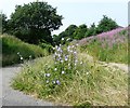
Wild chicory on the Trans Pennine Trail
The former Godley to Apethorn Railway line has been reclaimed for the Trans Pennine Trail and National Cycle Route #62. At several points there are separate paths of cyclists/walkers and horseriders. Wild chicory Image grows on the grass between. Common chicory, Cichorium intybus, is a somewhat woody, perennial herbaceous plant usually with bright blue flowers. When flowering, chicory has a tough, grooved, and more or less hairy stem, from 30 to 100 centimetres (10 to 40 in) tall. The leaves are stalked, lanceolate and unlobed. The flower heads are 2 to 4 centimetres (0.79 to 1.6 in) wide, and usually bright blue, rarely white or pink. There are two rows of involucral bracts; the inner are longer and erect, the outer are shorter and spreading. It flowers from July until October.The achenes have no pappus (feathery hairs), but do have toothed scales on top. https://en.wikipedia.org/wiki/Chicory
Image: © Gerald England Taken: 22 Jul 2013
0.06 miles
7
Blue flower
On the Trans Pennine Trail Image Common chicory, Cichorium intybus, is a somewhat woody, perennial herbaceous plant usually with bright blue flowers. When flowering, chicory has a tough, grooved, and more or less hairy stem, from 30 to 100 centimetres (10 to 40 in) tall. The leaves are stalked, lanceolate and unlobed. The flower heads are 2 to 4 centimetres (0.79 to 1.6 in) wide, and usually bright blue, rarely white or pink. There are two rows of involucral bracts; the inner are longer and erect, the outer are shorter and spreading. It flowers from July until October.The achenes have no pappus (feathery hairs), but do have toothed scales on top. https://en.wikipedia.org/wiki/Chicory
Image: © Gerald England Taken: 22 Jul 2013
0.06 miles
8
Trans Pennine Trail
Looking along the Trans Pennine Trail (former Godley to Apethorn Railway) towards the bridge connecting Donald Street (left) Image to Grange Road North.
Image: © Gerald England Taken: 29 Aug 2009
0.06 miles
9
Footpath to Walker Lane
Probably used nowadays mainly as an access to the Trans Pennine Trail, the cobblestones on this footpath suggest it is part of a more ancient route from Green Lane.
Image: © Gerald England Taken: 29 Aug 2009
0.06 miles
10
Trans Pennine Trail near Walkers Fold
The Trans Pennine Trail and National Cycle Route #62 runs here along what was the trackbed of the Godley Junction to Apethorn railway. At one time an iron footbridge crossed here http://hydonian.blogspot.co.uk/2011/02/iron-bridge.html but it has been demolished and now a footpath leads up to Donald Avenue. The sign in the centre directs horse riders to use the gravel bridleway on the left leaving the tarmacked path for cyclists and walkers. On the corner is a Sustrans Milepost Image of the Cockerel design which was erected in 2014.
Image: © Gerald England Taken: 21 Feb 2015
0.06 miles
  • ...