IMAGES TAKEN NEAR TO
Halton Street, HYDE, SK14 2NY

Introduction

This page details the photographs taken nearby to Halton Street, SK14 2NY by members of the Geograph project.

The Geograph project started in 2005 with the aim of publishing, organising and preserving representative images for every square kilometre of Great Britain, Ireland and the Isle of Man.

There are currently over 7.5m images from over14,400 individuals and you can help contribute to the project by visiting https://www.geograph.org.uk

Image Map


Images are licensed for reuse under creativecommons.org/licenses/by-sa/2.0
Notes
  • Clicking on the map will re-center to the selected point.
  • The higher the marker number, the further away the image location is from the centre of the postcode.

Image Listing (248 Images Found)

Images are licensed for reuse under creativecommons.org/licenses/by-sa/2.0
  • ...
Image
Details
Distance
1
Approaching J3 M67 - Hyde
Image: © Anthony Parkes Taken: 19 Jul 2010
0.05 miles
2
M67 at Hyde
The M67 motorway towards Hyde and Manchester viewed from the Halton Street bridge.
Image: © Gerald England Taken: 31 May 2011
0.06 miles
3
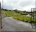
Track off Halton Street
Leading to Bonehill Dam. The Godley Brook flows through the valley on the right.
Image: © Gerald England Taken: 26 Jun 2012
0.07 miles
4
Footpath to Godley
A footpath between Hyde and Godley. On the left lies the valley of Godley Brook and Commercial Street. On the right lies the M67 motorway. Ahead is Halton Street.
Image: © Gerald England Taken: 20 Nov 2008
0.08 miles
5
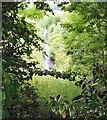
Godley Brook
A glimpse of the Godley Brook through the thick vegetation on Halton Street.
Image: © Gerald England Taken: 26 Jun 2012
0.08 miles
6
Footpath from Godley
A footpath between Godley and Hyde. On the right lies the valley of Godley Brook and Commercial Street. On the left lies the M67 motorway.
Image: © Gerald England Taken: 20 Nov 2008
0.11 miles
7
Halton Street
Off Mottram Road.
Image: © Gerald England Taken: 30 Jul 2016
0.11 miles
8
Behind Steeles Avenue
Road leading to land at the rear of Steeles Avenue from Brook Street. The M67 motorway lies behind the embankment on the left.
Image: © Gerald England Taken: 31 May 2011
0.12 miles
9
High Street Godley
St John's Terrace on the right dates from 1860 but has obviously been much modernised in recent years.
Image: © Gerald England Taken: 20 Nov 2008
0.12 miles
10
Godley Brook
Near to Godfrey Mill Image On the left is Commercial Street and on the right is a footpath through woods. This is just a little way upstream from Image One arm of Godley Brook comes down off Matley Moor, whilst another arm comes through Godley Vale Image and is culverted under the M67 motorway to join the other arm here.
Image: © Gerald England Taken: 20 Nov 2008
0.13 miles
  • ...