IMAGES TAKEN NEAR TO
Edward Street, HYDE, SK14 2BQ

Introduction

This page details the photographs taken nearby to Edward Street, SK14 2BQ by members of the Geograph project.

The Geograph project started in 2005 with the aim of publishing, organising and preserving representative images for every square kilometre of Great Britain, Ireland and the Isle of Man.

There are currently over 7.5m images from over14,400 individuals and you can help contribute to the project by visiting https://www.geograph.org.uk

Image Map


Images are licensed for reuse under creativecommons.org/licenses/by-sa/2.0
Notes
  • Clicking on the map will re-center to the selected point.
  • The higher the marker number, the further away the image location is from the centre of the postcode.

Image Listing (729 Images Found)

Images are licensed for reuse under creativecommons.org/licenses/by-sa/2.0
  • ...
Image
Details
Distance
1
M67 towards Manchester
Looking over the M67 towards Manchester from the Western end of Clark Way. The bridge crossing the motorway carries the railway line from Rose Hill (Marple) via Hyde Central to Hyde North, Guide Bridge and Manchester Piccadilly. Across the motorway lies the now empty Northern section of Edward Street following the demolition of the Caxton Works http://spadsky-hydedailyphoto.blogspot.com/2009/07/caxton-works-demolition.html Compare with the views in January 2010: Image and August 2009 Image
Image: © Gerald England Taken: 10 Apr 2011
0.02 miles
2
Bridge repairs off Canal Street
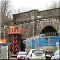
Workmen on the top of a scissor-platform are doing work on the railway viaduct carrying the Rose Hill (Marple) to Manchester (Piccadilly) line over Great Norbury Street, Manchester Road, the M67 and Dukinfield Road. This section accessed from Canal Street is between Manchester Road and the motorway. I assume they are probably pointing the stonework.
Image: © Gerald England Taken: 10 Jan 2014
0.02 miles
3
Westbound M67
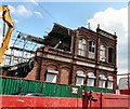
The M67 motorway looking Westbound towards Manchester from Clark Way. On the right is Caxton Mill, currently being demolished.
Image: © Gerald England Taken: 8 Aug 2009
0.02 miles
4
Westbound M67
The M67 from the Western Clark Road bridge. The bridge in the view carries the Rose Hill to Piccadilly railway line. Compare with the view in August 2009 Image since when the Caxton Works on Mary Street Image has been completely demolished.
Image: © Gerald England Taken: 18 Jan 2010
0.03 miles
5
M67 Motorway bridge
Viewed from private land at the end of Canal Street.
Image: © Gerald England Taken: 15 Nov 2007
0.03 miles
6
Caxton Works Demolished
The rubble remains of the Caxton Works on Edward Street. More information at http://spadsky-hydedailyphoto.blogspot.com/2009/08/caxton-demolition-continued.html
Image: © Gerald England Taken: 8 Aug 2009
0.04 miles
7
Demolition of Caxton Mill
The demolition of the Caxton Mill on Edward Street. More information at http://spadsky-hydedailyphoto.blogspot.com/2009/07/caxton-works-demolition.html
Image: © Gerald England Taken: 13 Jul 2009
0.04 miles
8
Doorway to Caxton Works
Two weeks after work started on the demolition of the Caxton Works, the carved doorway remains intact. For more information see http://spadsky-hydedailyphoto.blogspot.com/2009/07/caxton-works-demolition.html See also Image
Image: © Gerald England Taken: 25 Jul 2009
0.04 miles
9
Caxton corner
The corner of the Caxton Works on Mary Street.
Image: © Gerald England Taken: 19 Feb 2008
0.04 miles
10
Caxton Works: Detail
Detail on the Caxton Works.
Image: © Gerald England Taken: 19 Feb 2008
0.04 miles
  • ...