IMAGES TAKEN NEAR TO
Canal Street, HYDE, SK14 2BL

Introduction

This page details the photographs taken nearby to Canal Street, SK14 2BL by members of the Geograph project.

The Geograph project started in 2005 with the aim of publishing, organising and preserving representative images for every square kilometre of Great Britain, Ireland and the Isle of Man.

There are currently over 7.5m images from over14,400 individuals and you can help contribute to the project by visiting https://www.geograph.org.uk

Image Map


Images are licensed for reuse under creativecommons.org/licenses/by-sa/2.0
Notes
  • Clicking on the map will re-center to the selected point.
  • The higher the marker number, the further away the image location is from the centre of the postcode.

Image Listing (666 Images Found)

Images are licensed for reuse under creativecommons.org/licenses/by-sa/2.0
  • ...
Image
Details
Distance
1
Wharfinger House
The three-storey Wharfinger's Warehouse was erected by the Peak Forest Canal Company in 1828. It is a Grade II listed building now used as offices by the Tameside & Glossop Primary Care Mental Health Service. In the foreground two Canadian geese are resting in Moorfield Place, a housing estate built on the site of the former Automasters Engineering Works.
Image: © Gerald England Taken: 9 Sep 2012
0.01 miles
2
Canalside buildings north of Manchester Road, Hyde
Image: © John Slater Taken: 10 Aug 2013
0.01 miles
3
The Cheshire Ring, Manchester Road, Hyde
Image: © Alexander P Kapp Taken: 25 Nov 2011
0.02 miles
4
Cheshire Ring
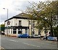
The Cheshire Ring pub at the corner of Manchester Road and Canal Street was originally the Navigation Hotel and sold Chesters Ales. Now it is home to "Sailors Beware" the local chapter of the Laurel and Hardy Appreciation Society and sells Beartown Ales. Image
Image: © Gerald England Taken: 25 Nov 2013
0.02 miles
5
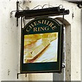
Sign for the Cheshire Ring
Sign of the Cheshire Ring Image
Image: © Gerald England Taken: 25 Nov 2013
0.02 miles
6
Cheshire Ring
The Cheshire Ring public house on Manchester Road in Hyde.
Image: © Peter McDermott Taken: 23 Aug 2014
0.02 miles
7
Cheshire Ring
The Cheshire Ring pub at the corner of Manchester Road and Canal Street was originally the Navigation Hotel and sold Chesters Ales. Now it is home to "Sailors Beware" the local chapter of the Laurel and Hardy Appreciation Society and sells Beartown Ales. Image
Image: © Gerald England Taken: 7 May 2015
0.02 miles
8
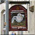
Cheshire Ring: Pub sign
The east facing side of the sign on the Cheshire Ring Image appears to be attached over the top of an earlier sign and differs from the west facing side Image
Image: © Gerald England Taken: 7 May 2015
0.02 miles
9
The Cheshire Ring public house
Manchester Road, Hyde.
Image: © Ian S Taken: 3 Mar 2022
0.02 miles
10
Peak Forest Canal
Viewed from Manchester Road Bridge. On the left now is Moorfield Place with easy access to the towpath.
Image: © Gerald England Taken: 26 Feb 2011
0.02 miles
  • ...