IMAGES TAKEN NEAR TO
Ann Street, HYDE, SK14 2BA

Introduction

This page details the photographs taken nearby to Ann Street, SK14 2BA by members of the Geograph project.

The Geograph project started in 2005 with the aim of publishing, organising and preserving representative images for every square kilometre of Great Britain, Ireland and the Isle of Man.

There are currently over 7.5m images from over14,400 individuals and you can help contribute to the project by visiting https://www.geograph.org.uk

Image Map


Images are licensed for reuse under creativecommons.org/licenses/by-sa/2.0
Notes
  • Clicking on the map will re-center to the selected point.
  • The higher the marker number, the further away the image location is from the centre of the postcode.

Image Listing (559 Images Found)

Images are licensed for reuse under creativecommons.org/licenses/by-sa/2.0
  • ...
Image
Details
Distance
1
Peak Forest Canal
Emerging from under the M67 motorway.
Image: © Gerald England Taken: 3 Jan 2008
0.00 miles
2
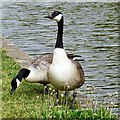
Two Canada Geese
By the Peak Forest Canal Image
Image: © Gerald England Taken: 19 May 2014
0.01 miles
3
Canada Geese at Moorfield Place
Two geese Image by the Peak Forest Canal.
Image: © Gerald England Taken: 19 May 2014
0.01 miles
4
A Turn in the Canal
The Peak Forest Canal after crossing under Manchester Road (off to the left), skirts around the Automasters Works (since demolished) turning West before turning North again passing under the M67 motorway Image (off to the right).
Image: © Gerald England Taken: 15 Nov 2007
0.01 miles
5
Peak Forest Canal
Approaching the winding hole at Hyde.
Image: © Gerald England Taken: 2 May 2017
0.02 miles
6
Peak Forest Canal
After crossing under the M67 Motorway, the Peak Forest Canal turn Eastwards towards Hyde Town Centre. Compare with the views in January 2008 Image and January 2010 Image
Image: © Gerald England Taken: 9 Sep 2010
0.02 miles
7
Sluice gates on the Peak Forest Canal
The new houses on the left are part of Moorside Place, an estate built on the site of the Automasters Engineering Works. Ahead is the bridge and viaduct carrying the Rose Hill to Piccadilly railway line. Compare with the view in 2008 Image
Image: © Gerald England Taken: 26 Feb 2011
0.02 miles
8
Peak Forest Canal
Sluice on the side of the Peak Forest Canal. On the left are new houses, part of Moorside Place built on the site of the Automasters Engineering Works. On the right is the M67 motorway. Compare with the views in 2008 Image and 2010 Image
Image: © Gerald England Taken: 26 Feb 2011
0.02 miles
9
Sluice gates on the Peak Forest Canal
These sluice gates feed excess water on the Peak Forest Canal into the Wilson Brook. On the right are house on Moorfield Place, built on the site of the former Automasters Works.
Image: © Gerald England Taken: 19 Aug 2013
0.02 miles
10
Sluice gate
The Peak Forest Canal approaching the winding hole (an area widened out to allow craft to turn round) in Hyde. On the left is the M67 motorway. Ahead is a 19th century warehouse and behind that a train can be seen on the Manchester to Rose Hill railway. The sluice gate on the right allows water to run off into Wilson Brook. The houses behind the fence are part of Moorfield Place which was built on the site of the former Automasters Engineering Works.
Image: © Gerald England Taken: 2 May 2017
0.02 miles
  • ...