IMAGES TAKEN NEAR TO
Meadow Street, HYDE, SK14 1RE

Introduction

This page details the photographs taken nearby to Meadow Street, SK14 1RE by members of the Geograph project.

The Geograph project started in 2005 with the aim of publishing, organising and preserving representative images for every square kilometre of Great Britain, Ireland and the Isle of Man.

There are currently over 7.5m images from over14,400 individuals and you can help contribute to the project by visiting https://www.geograph.org.uk

Image Map


Images are licensed for reuse under creativecommons.org/licenses/by-sa/2.0
Notes
  • Clicking on the map will re-center to the selected point.
  • The higher the marker number, the further away the image location is from the centre of the postcode.

Image Listing (1236 Images Found)

Images are licensed for reuse under creativecommons.org/licenses/by-sa/2.0
  • ...
Image
Details
Distance
1
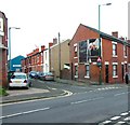
Meadow Street
Short street with terraced housing on one side and industrial units on the other. Across Stockport Road can be seen the Clarkes Arms Image on the corner of Lumn Road.
Image: © Gerald England Taken: 5 Apr 2010
0.01 miles
2
Meadow Street
A cul-de-sac off Stockport Road with terraced housing on one side and industrial units on the other. In the distance can just be seen the tower of St George's church.
Image: © Gerald England Taken: 5 Sep 2006
0.01 miles
3
Meadow Street
A cul-de-sac off Stockport Road with terraced housing on one side and industrial units on the other. In the last two months, "Street" on the street sign has been covered up by the new "slow down" sign for the James Clock roundabout. Image
Image: © Gerald England Taken: 16 May 2006
0.01 miles
4
Indico Rubber Company
In one of the units on the former Redfern Rubber Works on Meadow Street, Indico (established 1973) continue to manufacture rubber products.
Image: © Gerald England Taken: 3 Sep 2011
0.02 miles
5
Fossil tree signpost painted
Since being erected earlier this year this Sustrans signpost Image of the "Fossil Tree" design by John Mills has now been painted.
Image: © Gerald England Taken: 22 Sep 2014
0.02 miles
6
Sustrans signpost near Stockport Road
This National Cycle Network Milepost.is one of six mileposts erected on this stretch of the Trans Pennine Trial alongside the former Godley Junction to Apethorn railway line. It was erected in 2014 Image
Image: © Gerald England Taken: 19 Apr 2020
0.02 miles
7
Fossil Tree milepost near Stockport Road
The milepost which was erected in spring 2014 Image and later painted Image is now being encroached upon by the vegetation.
Image: © Gerald England Taken: 3 Aug 2015
0.02 miles
8
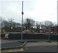
After the fire
Looking from Osborne Road across the cutting (which contained the former Godley Junction to Apethorn railway) to the remains of the former Redfern Rubber Works, latterly Amalgamated Signs Ltd Image and more recently Visual Architects ( https://visual-architects.com/ ) . A huge fire on Monday 22nd January 2024 destroyed the whole building. Behind the remaining façade the rest of the building is being demolished.
Image: © Gerald England Taken: 25 Jan 2024
0.03 miles
9
Former Redfern Rubber Works
A huge fire on Monday 22nd January 2024 destroyed the former Redfern Rubber Works, latterly Amalgamated Signs Ltd Image and more recently Visual Architects ( https://visual-architects.com/ ) . The building is being demolished. The footpath and bus stop on Market Street have been closed. Temporary traffic lights are controlling traffic.
Image: © Gerald England Taken: 25 Jan 2024
0.03 miles
10
Entrance to Trans Pennine Trail
The entrance to the Trans Pennine Trail and National Cycle Route #62 off Osborne Road.
Image: © Gerald England Taken: 28 Dec 2011
0.03 miles
  • ...