IMAGES TAKEN NEAR TO
Haughton Street, HYDE, SK14 1QR

Introduction

This page details the photographs taken nearby to Haughton Street, SK14 1QR by members of the Geograph project.

The Geograph project started in 2005 with the aim of publishing, organising and preserving representative images for every square kilometre of Great Britain, Ireland and the Isle of Man.

There are currently over 7.5m images from over14,400 individuals and you can help contribute to the project by visiting https://www.geograph.org.uk

Image Map


Images are licensed for reuse under creativecommons.org/licenses/by-sa/2.0
Notes
  • Clicking on the map will re-center to the selected point.
  • The higher the marker number, the further away the image location is from the centre of the postcode.

Image Listing (1482 Images Found)

Images are licensed for reuse under creativecommons.org/licenses/by-sa/2.0
  • ...
Image
Details
Distance
1
Dawson Street Covered Bridge
A covered bridge connects buildings either side of Dawson Street on the Redfern Industrial Estate.
Image: © Gerald England Taken: 1 Sep 2008
0.01 miles
2
Haughton Street
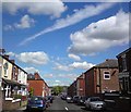
From Green Street looking towards Market Street on a day of clear blue skies. Compare with the view a month ago Image
Image: © Gerald England Taken: 30 May 2020
0.01 miles
3
Haughton Street
From the corner of Green Street looking down Haughton Street towards Market Street and the foot of the Pennine Hills in the distance.
Image: © Gerald England Taken: 15 May 2014
0.01 miles
4
Haughton Street
Image: © Gerald England Taken: 27 Apr 2020
0.01 miles
5
Haughton Street
Image: © Gerald England Taken: 6 Apr 2021
0.01 miles
6
Bradbury Street
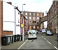
Until 2018 an industrial building occupied the space beyond the terraced houses on the right Image It was connected two storeys up to the building on Dawson Street by a covered bridge. That has now been demolished to provide extra parking for the Stoneacre motor group.
Image: © Gerald England Taken: 4 May 2020
0.01 miles
7
Bradbury Street
The top end of Bradbury Street between Haughton Street and Dawson Street. On one side are terraced houses. On the other is part of the former Redferns Rubber Works which is connected to another part on Dawson Street via a closed bridge. Some parts of the works are used by a variety of small businesses and the main building supports a number of mobile phone masts. Bollards at the top of Bradbury Street prevent vehicular access onto Dawson Street.
Image: © Gerald England Taken: 6 Aug 2013
0.02 miles
8
Green Street
Leading from Dawson Street to Dowson Road. In the background is St George's Church.
Image: © Gerald England Taken: 21 May 2020
0.02 miles
9
Haughton Street
Leading to Markland Street and Swains Valley from where a path leads to the Trans Pennine Trail.
Image: © Gerald England Taken: 25 Apr 2022
0.02 miles
10
Green Street
Leading from Dawson Street to Dowson Road. In the background is St George's Church. Opposite view Image
Image: © Gerald England Taken: 5 Apr 2010
0.03 miles
  • ...