IMAGES TAKEN NEAR TO
Park Terrace, GLOSSOP, SK13 8HU

Introduction

This page details the photographs taken nearby to Park Terrace, SK13 8HU by members of the Geograph project.

The Geograph project started in 2005 with the aim of publishing, organising and preserving representative images for every square kilometre of Great Britain, Ireland and the Isle of Man.

There are currently over 7.5m images from over14,400 individuals and you can help contribute to the project by visiting https://www.geograph.org.uk

Image Map


Images are licensed for reuse under creativecommons.org/licenses/by-sa/2.0
Notes
  • Clicking on the map will re-center to the selected point.
  • The higher the marker number, the further away the image location is from the centre of the postcode.

Image Listing (244 Images Found)

Images are licensed for reuse under creativecommons.org/licenses/by-sa/2.0
  • ...
Image
Details
Distance
1
Footpath to Philip Howard Road
From Victoria Street.
Image: © Gerald England Taken: 3 Apr 2017
0.02 miles
2
Victoria Street, Glossop
Image: © Glyn Drury Taken: 6 Sep 2009
0.02 miles
3
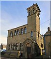
Littlemoor Chapel and School, Whitfield.
The Chapel opened in 1811 and the formation of a Church made in 1812. In 1840 a new school was built and this was enlarged twelve years later in 1852. The Chapel was enlarged 1845. A new and enlarged school premises opened in 1881 as a Day School with 81 pupils. The graveyard containing 3,000 bodies was exhumed and re-interred at Glossop Municipal Cemetery in April 1976 and a memorial stone to those once buried at Littlemoor can now be seen there. The Chapel eventually closed and is now used as a Fitness Centre whilst the school has been converted into apartments. More information on this and other Glossop churches can be found on the web pages of Glossop Heritage Trust http://www.glossopheritage.co.uk/indep.htm
Image: © Gerald England Taken: 3 Apr 2017
0.03 miles
4
Littlemoor Chapel and School, Whitfield
The chapel (out of sight on the left) dates from 1811. In the background is the school which was rebuilt in 1881. The car park is on the site of the graveyard. 3,000 bodies was exhumed and re-interred at Glossop Municipal Cemetery in April 1976 and a memorial stone to those once buried at Littlemoor can now be seen there. The Chapel eventually closed and is now used as a Fitness Centre whilst the school has been converted into apartments. More information on this and other Glossop churches can be found on the web pages of Glossop Heritage Trust http://www.glossopheritage.co.uk/indep.htm
Image: © Gerald England Taken: 3 Apr 2017
0.03 miles
5
Glossop Brook
Flowing from under Philip Howard Road.
Image: © Gerald England Taken: 24 Dec 2008
0.04 miles
6
Harehills: Plaque
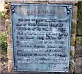
The brass plaque at Harehills Park Image also know as the People's Park Image reads: HAREHILLS THE SITE OF THESE PLEASURE GROUNDS AND OF PHILIP HOWARD ROAD WAS PRESENTED TO THE TOWN IN THE YEAR 1921 BY THE RT.HON. BERNARD EDWARD LORD HOWARD BARON HOWARD OF GLOSSOP IN MEMORY OF HIS SON THE HON. PHILIP FITZALAK HOWARD WHO FELL IN THE SERVICE OF HIS COUNTRY DURING THE EUROPEAN WAR 1914-1918 AND ALSO IN APPRECIATION OF THE MEN OF GLOSSOP WHO SERVED DURING THE WAR.
Image: © Gerald England Taken: 3 Apr 2017
0.04 miles
7
The People's Park
Between Glossop Brook and Philip Howard Road. It is otherwise known as Harehills Park. The site was presented to the town in 1921 by the Rt.Hon. Bernard Edward, Lord Howard, Baron Howard of Glossop in memory of his son Philip Fitzalak Howard who fell in the service of his country during the European War 1914-1918 and also in appreciation of the men of Glossop who served during the war.
Image: © Gerald England Taken: 3 Apr 2017
0.04 miles
8
Victoria Street
View North towards the Town Hall.
Image: © Darren Haddock Taken: 19 Oct 2006
0.04 miles
9
Sign of the Brook Tavern
Sign for the Brook Tavern Image
Image: © Gerald England Taken: 5 Aug 2017
0.04 miles
10
Victoria Street, looking north from the end of Derby Road
Image: © Chris Taken: 22 Apr 2013
0.04 miles
  • ...