1
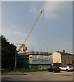
High Street West, Glossop
An unusual quiet spell on the A57 through Glossop town centre.
Image: © Benjamin Hopkins
Taken: 31 Jan 2010
0.01 miles
2
High Street West, Glossop
I don't know if the greengrocers on the right is still in the Sowerbutt family, but I suspect it is. The most famous Sowerbutt was Bill, a member of the original Gardener's Question Time panel.
The shop next to it (blue frontage just visible) is the largest branch of the award-winning JW Mettrick.
Image: © David Lally
Taken: 13 Aug 2009
0.04 miles
3
Glossop High Street
Image: © David Lally
Taken: 5 Jun 2018
0.04 miles
4
Calico Court
Retirement apartments under construction by McCarthy & Stone.
Image: © Gerald England
Taken: 15 Sep 2016
0.04 miles
5
Calico Court
Retirement apartments built by McCarthy & Stone.
Image: © Gerald England
Taken: 3 Apr 2017
0.05 miles
6
Remembrance Sunday Parade
Traffic was stopped to allow the parade to enter Norfolk Square for a service at the cenotaph.
Image: © Graham Hogg
Taken: 13 Nov 2011
0.05 miles
7
The People's Park
The area south of the Glossop Brook is a small park. On the north side of the brook is a development of retirement apartments by McCarthy & Stone called Calico Court.
It is also known as Harehills Park. The site was presented to the town in 1921 by the Rt.Hon. Bernard Edward, Lord Howard, Baron Howard of Glossop in memory of his son Philip Fitzalak Howard who fell in the service of his country during the European War 1914-1918 and also in appreciation of the men of Glossop who served during the war.
Image: © Gerald England
Taken: 3 Apr 2017
0.05 miles
8
Open public toilets
Council toilets on the market ground in Glossop.
Unlike so many these are still in operation.
The building behind, now an accountancy firm's offices, was previously The Bridge Inn.
Image: © David Lally
Taken: 5 Jun 2018
0.06 miles
9
High Street West, Glossop
Looking east toward the town hall. The opticians in the foreground (on the corner of Market Street) was once a pub called The Newmarket. In the mid-eighties it closed with what (for me as a vegetarian beer-lover) can only be said to be the worst of fates - it reopened as a Dewhurst's butchers shop.
Image: © David Lally
Taken: 13 Aug 2009
0.06 miles
10
The People's Park
Between Glossop Brook and Philip Howard Road. It is otherwise known as Harehills Park.
The site was presented to the town in 1921 by the Rt.Hon. Bernard Edward, Lord Howard, Baron Howard of Glossop in memory of his son Philip Fitzalak Howard who fell in the service of his country during the European War 1914-1918 and also in appreciation of the men of Glossop who served during the war.
Image: © Gerald England
Taken: 3 Apr 2017
0.06 miles


