IMAGES TAKEN NEAR TO
Railway Street, GLOSSOP, SK13 7ED

Introduction

This page details the photographs taken nearby to Railway Street, SK13 7ED by members of the Geograph project.

The Geograph project started in 2005 with the aim of publishing, organising and preserving representative images for every square kilometre of Great Britain, Ireland and the Isle of Man.

There are currently over 7.5m images from over14,400 individuals and you can help contribute to the project by visiting https://www.geograph.org.uk

Image Map


Images are licensed for reuse under creativecommons.org/licenses/by-sa/2.0
Notes
  • Clicking on the map will re-center to the selected point.
  • The higher the marker number, the further away the image location is from the centre of the postcode.

Image Listing (268 Images Found)

Images are licensed for reuse under creativecommons.org/licenses/by-sa/2.0
  • ...
Image
Details
Distance
1
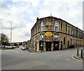
Liberal Hall
The old Liberal Hall with its distinctive curved elevation and elongated arched second floor windows occupies the corner of Edward Street and Railway Street. Image Image
Image: © Gerald England Taken: 13 Apr 2016
0.02 miles
2
Liberal Hall: namestone
The namestone on the Liberal Hall Image
Image: © Gerald England Taken: 13 Apr 2016
0.02 miles
3
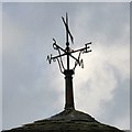
Liberal Hall: weathervane
The weather vane on the Liberal Hall Image West seems to have taken a battering.
Image: © Gerald England Taken: 13 Apr 2016
0.02 miles
4
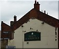
Nubolic Soap at The Moon & Sixpence
Old time soap advert on a wall next to a Gauguin inspired pub in Glossop. The pub sign is on the inside of the neighbouring, demolished, building.
Image: © Peter Barr Taken: 15 Apr 2011
0.03 miles
5
Glossop Railway Station
The station was built in 1847 by the Duke of Norfolk. The Co-op supermarket now stands on the left of the station.
Image: © Benjamin Hopkins Taken: 31 Jan 2010
0.03 miles
6
Howard Street, Glossop
Looking east along Howard Street towards Norfolk Street and The George Hotel.
Image: © Benjamin Hopkins Taken: 31 Jan 2010
0.03 miles
7
Howard Street, Glossop
Looking east along Howard Street towards Norfolk Street.
Image: © Benjamin Hopkins Taken: 31 Jan 2010
0.03 miles
8
Masonic Hall & Oxfam
The Oxfam shop on Henry Street occupies the ground floor of Glossop Masonic Hall. On the left is a unisex hairdressers called "C'Est La Vie".
Image: © Gerald England Taken: 13 Apr 2016
0.03 miles
9
Traction Engine
At Glossop vintage weekend
Image: © Paul Foster Taken: 29 May 2022
0.03 miles
10
The Moon and Sixpence
On the corner of Railway Street and Bernard Street. Next door is the Blues Club (now closed I think). It will be about twenty years since the Moon and Sixpence was given that name, for many years its previous name - The Fleece - was still visible on the gable, but is now obscured by a wooden sign, missing an O and an E. April 2016 My thanks to Gerald http://www.geograph.org.uk/profile/22742 For letting me know the previous name as I had forgotten it.
Image: © David Lally Taken: 13 Aug 2009
0.03 miles
  • ...