IMAGES TAKEN NEAR TO
Charles Street, GLOSSOP, SK13 7DJ

Introduction

This page details the photographs taken nearby to Charles Street, SK13 7DJ by members of the Geograph project.

The Geograph project started in 2005 with the aim of publishing, organising and preserving representative images for every square kilometre of Great Britain, Ireland and the Isle of Man.

There are currently over 7.5m images from over14,400 individuals and you can help contribute to the project by visiting https://www.geograph.org.uk

Image Map


Images are licensed for reuse under creativecommons.org/licenses/by-sa/2.0
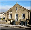
Notes
  • Clicking on the map will re-center to the selected point.
  • The higher the marker number, the further away the image location is from the centre of the postcode.

Image Listing (249 Images Found)

Images are licensed for reuse under creativecommons.org/licenses/by-sa/2.0
  • ...
Image
Details
Distance
1
Norfolk Street, Glossop
Looking north along Norfolk Street with Fitzalan Street on the left and King Edward Avenue on the right.
Image: © Benjamin Hopkins Taken: 17 Jan 2010
0.02 miles
2
King Edward Avenue, Glossop
Looking east up King Edward Avenue with the A57 Snake Pass seen in the distance.
Image: © Benjamin Hopkins Taken: 17 Jan 2010
0.02 miles
3
Glossop - The Star Inn
An alternative view is available at Image
Image: © Dave Bevis Taken: 22 Aug 2010
0.04 miles
4
Talbot Street
Viewed from the platform of Glossop Station.
Image: © Gerald England Taken: 12 Jul 2012
0.04 miles
5
Norfolk Street in Glossop
Looking in the direction of the town centre on a showery late afternoon in early March.
Image: © Jonathan Clitheroe Taken: 3 Mar 2012
0.04 miles
6
Glossop Station
The entrance to Glossop Station on Norfolk Street and the Star Inn on the corner of Howard Street.
Image: © Gerald England Taken: 24 Dec 2008
0.04 miles
7
Howard Street Glossop
Howard Street as viewed from Glossop Railway Station's only platform.
Image: © Stephen Burton Taken: 23 Apr 2015
0.05 miles
8
Howard Medical Centre
Originally the Wesleyan Reform Chapel Sunday School. The Chapel itself was demolished in 1965.
Image: © Gerald England Taken: 17 Nov 2009
0.05 miles
9
Howard Medical Centre
Originally the Wesleyan Reform Chapel Sunday School. The Chapel itself was demolished in 1965.
Image: © Gerald England Taken: 19 Nov 2021
0.05 miles
10
End of the line at Glossop station
Image: © John Slater Taken: 11 Aug 2012
0.05 miles
  • ...