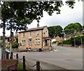
IMAGES TAKEN NEAR TO
Martlet Avenue, STOCKPORT, SK12 2JH

Introduction

This page details the photographs taken nearby to Martlet Avenue, SK12 2JH by members of the Geograph project.

The Geograph project started in 2005 with the aim of publishing, organising and preserving representative images for every square kilometre of Great Britain, Ireland and the Isle of Man.

There are currently over 7.5m images from over14,400 individuals and you can help contribute to the project by visiting https://www.geograph.org.uk

Image Map


Images are licensed for reuse under creativecommons.org/licenses/by-sa/2.0
Notes
  • Clicking on the map will re-center to the selected point.
  • The higher the marker number, the further away the image location is from the centre of the postcode.

Image Listing (49 Images Found)

Images are licensed for reuse under creativecommons.org/licenses/by-sa/2.0
  • ...
Image
Details
Distance
1
Jacksons Edge road Disley
Image: © Steve Fareham Taken: 30 Nov 2015
0.10 miles
2
Towards Widowhurst and Goyt Valley
Image: © Chris Wimbush Taken: 3 Nov 2010
0.15 miles
3
Dandy Cock
A pub in the centre of Disley that welcomes bikers.
Image: © Gerald England Taken: 14 May 2010
0.19 miles
4
RBS Bank, Disley
The RBS Bank at Disley was originally a post office.
Image: © Gerald England Taken: 1 Jun 2017
0.21 miles
5
Disley station
Manchester-Buxton train departing
Image: © Peter Whatley Taken: 25 Mar 1989
0.21 miles
6
Disley Station
The entrance to Disley Station off the A6.
Image: © Gerald England Taken: 1 Jun 2017
0.21 miles
7
Market Street Disley, The Dandy Cock
Image: © David Dixon Taken: 4 Aug 2014
0.21 miles
8
Fountain Square Disley
Image: © Steve Fareham Taken: 30 Nov 2015
0.21 miles
9
Disley Station
Simple buildings on the Buxton to Stockport line.
Image: © Mike Faherty Taken: 27 Dec 2014
0.21 miles
10
Disley, toilet
On Station Approach.
Image: © Mike Faherty Taken: 27 Dec 2014
0.21 miles
  • ...