1
Across the Goyt Valley north of Danebank in Cheshire
Looking east-north-east from the Peak Forest canal near Higgins Clough Bridge.
Image: © Roger Kidd
Taken: 7 Sep 2014
0.12 miles
2
Weir on the River Goyt at Disley
Image: © Graham Hogg
Taken: 16 May 2011
0.14 miles
3
Goyt Valley Landscape, near Newtown, Derbyshire
Image: © Roger D Kidd
Taken: 26 Aug 2007
0.15 miles
4
View across the Goyt Valley near Danebank in Cheshire
Near Cloughside Farm, looking north across Higgins Clough and the Goyt Valley from the Upper Peak Forest Canal. Across the valley are houses on High Lea Road.
Image: © Roger Kidd
Taken: 7 Sep 2014
0.19 miles
5
Peak Forest Canal, Disley
Here contouring high about the Goyt valley.
Image: © Dave Dunford
Taken: 2 Jan 2012
0.19 miles
6
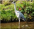
Grey Heron, standing still
On the Peak Forest Canal at Disley. This bird seemed quite oblivious to our passing, and to the narrow boat moored nearby. On previous attempts to get a shot of a heron from a narrow boat, their annoying habit has been to wait till the last possible minute, while I am fiddling with camera, then to take off and fly leisurely to their next landing spot, where the whole frustrating business is carried out again.
Image: © Peter Barr
Taken: 28 Jul 2011
0.20 miles
7
Upper Peak Canal north of Danebank in Cheshire
This shows the Peak Forest Canal near Danebank, looking west from near Dryhurst Bridge (No 26) towards Disley and Marple. The housing is in Ashwood Road.
Image: © Roger Kidd
Taken: 7 Sep 2014
0.21 miles
8
Peak Forest Canal west of New Mills, Cheshire
The narrowing of the channel here show where a former swing or lift bridge used to be. Can anyone let us know when it was removed?
Image: © Roger D Kidd
Taken: 5 Sep 2014
0.21 miles
9
Disley, stile
On the northern bank of Peak Forest Canal.
Image: © Mike Faherty
Taken: 27 Dec 2014
0.22 miles
10
Private moorings north of Danebank in Cheshire
This is the Upper Peak Forest Canal north of Higgins Clough Swing Bridge, No 25.
Image: © Roger Kidd
Taken: 7 Sep 2014
0.22 miles


