IMAGES TAKEN NEAR TO
Brown Street, STOCKPORT, SK1 1RS

Introduction

This page details the photographs taken nearby to Brown Street, SK1 1RS by members of the Geograph project.

The Geograph project started in 2005 with the aim of publishing, organising and preserving representative images for every square kilometre of Great Britain, Ireland and the Isle of Man.

There are currently over 7.5m images from over14,400 individuals and you can help contribute to the project by visiting https://www.geograph.org.uk

Image Map


Images are licensed for reuse under creativecommons.org/licenses/by-sa/2.0
Notes
  • Clicking on the map will re-center to the selected point.
  • The higher the marker number, the further away the image location is from the centre of the postcode.

Image Listing (1627 Images Found)

Images are licensed for reuse under creativecommons.org/licenses/by-sa/2.0
  • ...
Image
Details
Distance
1
Othello's Caf? Bar
On Brown Street.
Image: © Gerald England Taken: 28 Jan 2013
0.01 miles
2
Myle Nails
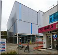
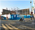
At the end of Brown Street is a nail bar. Behind the fencing work is continuing for the Redrock Development which according to a poster is due to open in less than a month.
Image: © Gerald England Taken: 19 Oct 2017
0.01 miles
3
Bridgefield Street
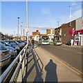
For buses into Stockport from the north-east sector Bridgefield Street is the main route in and out.
Image: © Gerald England Taken: 7 Mar 2015
0.01 miles
4
Christmas Tree on Prince's Street
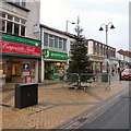
Outside Greenhalgh's bakery shop. Next door is "Exquisite Nails" above which is "Life" a pregnancy care centre.
Image: © Gerald England Taken: 14 Dec 2015
0.02 miles
5
Bonmarch? Stockport
On Prince's Street.
Image: © Gerald England Taken: 14 Mar 2015
0.02 miles
6
Prince's Street
With the country still in lockdown due to the coronavirus pandemic nearly all the shops are closed and the street is virually deserted. Although the Bonmarché shop Image shut down a few years ago one of its signs is still showing.
Image: © Gerald England Taken: 13 Jun 2020
0.02 miles
7
Prince's Street
A pedestrian area on Prince's Street. M&S is on the right. On the left are Specsavers and the Santander Bank (I think this was formerly a branch of Bradford & Bingley). There looks to be what I think is a magpie's nest in one of the trees.
Image: © Gerald England Taken: 26 Jan 2012
0.02 miles
8
Christmas Tree on Prince's Street
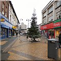
On the left is an adult gaming centre. On the right is a charity shop for Shelter who help homeless people.
Image: © Gerald England Taken: 14 Dec 2015
0.02 miles
9
Brown Street
Connecting Bridgefield Street to Prince's Street.
Image: © Gerald England Taken: 3 May 2014
0.02 miles
10
Brown Street
Shops on the west side of Brown Street off Prince's Street have been demolished and the vacant land is being used as a site office for the Redrock development.
Image: © Gerald England Taken: 2 Jan 2017
0.02 miles
  • ...