IMAGES TAKEN NEAR TO
High Bank Side, STOCKPORT, SK1 1HG

Introduction

This page details the photographs taken nearby to High Bank Side, SK1 1HG by members of the Geograph project.

The Geograph project started in 2005 with the aim of publishing, organising and preserving representative images for every square kilometre of Great Britain, Ireland and the Isle of Man.

There are currently over 7.5m images from over14,400 individuals and you can help contribute to the project by visiting https://www.geograph.org.uk

Image Map


Images are licensed for reuse under creativecommons.org/licenses/by-sa/2.0
Notes
  • Clicking on the map will re-center to the selected point.
  • The higher the marker number, the further away the image location is from the centre of the postcode.

Image Listing (1718 Images Found)

Images are licensed for reuse under creativecommons.org/licenses/by-sa/2.0
  • ...
Image
Details
Distance
1
Dawson's Music Shop
On Tatton Street.
Image: © Gerald England Taken: 13 Nov 2010
0.00 miles
2
Long Ramp
Footpath linking St Peters Square to Chestergate.
Image: © Gerald England Taken: 16 May 2009
0.01 miles
3
High Bank Steps
An isolated remnant of High Bank is reached by stone steps. A bench sits under the wall of the new road to St Petersgate from the car park on the top of Merseyway.
Image: © Gerald England Taken: 8 Jun 2013
0.02 miles
4
Casino 36
At 36 St Petersgate opposite the end of Tatton Street.
Image: © Gerald England Taken: 18 Jul 2009
0.02 miles
5
Stockport Air Raid Shelter Tours
Currently closed due to the coronavirus pandemic.
Image: © Gerald England Taken: 4 Jul 2020
0.02 miles
6
Underbank Hall, Great Underbank, Stockport
Built in the late 15/early 16th century
Image: © D Williams Taken: Unknown
0.02 miles
7
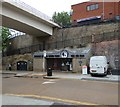
Stockport Air Raid Shelters, Chestergate
This is the entrance to the shelters, the associated museum and shop http://bit.ly/P4NwyA The bridge gives access to a multi-storey car park from Tatton Street.
Image: © Robin Stott Taken: 17 Mar 2012
0.02 miles
8
Shadows down High Bank
The steep footpath leading from St Peter's down the side of High Bank to the Underbanks. At the top is the bridge from St Petersgate going over Chestergate to the car parks on the roof of the Merseyway Shopping Centre.
Image: © Gerald England Taken: 4 Jul 2015
0.02 miles
9
Central Youth
The offices of Central Youth on St Peter's Square. They offer free and confidential advice, information, counselling and sexual health services for young people aged 11 to 25. Note: Information correct at time the photographic was taken (2012).
Image: © Gerald England Taken: 13 Oct 2012
0.02 miles
10
Signs on Chestergate
In the foreground are pedestrian signposts on Chestergate. Across the road is the entrance to the Stockport Air Raid shelters, behind which are footpaths leading up to High Bank Side and St Peter's Square. Top left is the bridge linking St Petersgate to the car park on the roof of the Merseyway Shopping Centre.
Image: © Gerald England Taken: 28 May 2013
0.03 miles
  • ...