1
Byrons Lane - Macclesfield
Image: © Anthony Parkes
Taken: 8 Jan 2012
0.09 miles
2
Byrons Lane at Slack Street
Image: © Colin Pyle
Taken: 12 Oct 2019
0.10 miles
3
Byron's Lane, Macclesfield
Image: © JThomas
Taken: 5 Jul 2024
0.11 miles
4
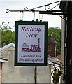
Sign for the Railway View public house
Image: © JThomas
Taken: 5 Jul 2024
0.12 miles
5
The Railway View public house
Image: © JThomas
Taken: 5 Jul 2024
0.13 miles
6
Steam engine, London Road Mill, Macclesfield
The incomplete remains of a vertical single cylinder steam engine. This is possibly of 1840s vintage and may have been out of use since 1894. It was quite a surprise to discover yet another incomplete vertical engine.
Image: © Chris Allen
Taken: 26 Jun 1993
0.13 miles
7
Engine house, London Road Mill, Macclesfield
This decrepit lean-to contained the incomplete remains of the vertical steam engine that powered this former silk mill. The building has now been replaced by a modern look-alike that still contains the remains of the engine.
Image: © Chris Allen
Taken: 26 Jun 1993
0.14 miles
8
Derelict site awaiting housing development in Macclesfield, Cheshire
Seen by looking north-west from the Macclesfield Canal, this area awaiting housing development is off Gunco Lane.
The former R H Stevens Transport Ltd haulage site has planning permission for 88 homes.
The dark church clock tower on the skyline is that of the little used Christ Church in Great King Street.
Examining newer aerial images, it seems that the building by the trees
on the left, which appears to be undergoing modernisation in 2014, did not progress to be part of the final development.
Image: © Roger Kidd
Taken: 8 Sep 2014
0.15 miles
9
Albion Mill, Macclesfield
A former silk mill, a Grade II listed building, on London Road. At the top is the name and the date of construction, 1843. It is empty and for sale, as a residential redevelopment opportunity.
Image: © David Weston
Taken: 1 Sep 2013
0.15 miles
10
London Road Mill
Textile Mill - Silk manufacturing. Now a glass company. The lean to is a modern reconstruction housing the remains of a stationary steam engine believed to be c1840s vintage. The photographer is not trespassing but is on the public side of a little brook.
Image: © Chris Allen
Taken: 20 Jan 2002
0.15 miles


