1
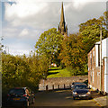
The Boarhound, Macclesfield
The Boarhound public house at the corner of Brook Street and Cawley Street.
Image: © David Dixon
Taken: 3 Oct 2012
0.05 miles
2
Brook Street, Macclesfield
Image: © JThomas
Taken: 5 Jul 2024
0.06 miles
3
St Paul's churchyard gate, Macclesfield
The main gateway to St Paul's churchyard from Brook Street.
Image: © John S Turner
Taken: 20 Jun 2013
0.07 miles
4
The Silk Road (A523), Macclesfield
Image: © JThomas
Taken: 5 Jul 2024
0.07 miles
5
Looking along Goodall Street, Macclesfield
The Wharf public house, on the corner with Brook Street, is closed. Slightly odd appearance is because the corner is greater than a right angle.
Image: © Robin Stott
Taken: 27 Apr 2011
0.07 miles
6
Brook Street crossroads, Macclesfield
At this point, Brook Street crosses The Silk Road as the former climbs east out of the town centre. The Silk Road, part of the A523, forms an inner bypass for Macclesfield, and is named in honour of the industry with which the town was once synonymous.
Image: © Richard Vince
Taken: 12 Oct 2013
0.08 miles
7
The path to St Paul's, Macclesfield
Image: © John Lord
Taken: 31 Dec 2012
0.08 miles
8
The Parish Church of St Paul, Macclesfield
St Paul's Church, viewed from Cawley Street.
St Paul's Parish Church, Macclesfield, is a Grade II listed building. (http://list.english-heritage.org.uk/resultsingle.aspx?uid=1218224 National Heritage List for England). It was built in 1843–44, an example of a "Commissioners' Church" (http://en.wikipedia.org/wiki/Commissioners%27_church ), having received a grant towards its construction from the Church Building Commission.
Image: © David Dixon
Taken: 3 Oct 2012
0.09 miles
9
St Paul's war memorial 1914-1919
This memorial to the men of St Paul's who died in the 'Great War' is at the south side of the church at the top of the main churchyard path.
Image: © John S Turner
Taken: 20 Jun 2013
0.09 miles
10
St Paul's churchyard wall in Green Street, Macclesfield
Looking along St Paul's west-facing churchyard wall from the junction of Green Street with Brook Street. Green Street is now closed off at this point as the busy A525 'The Silk Road' takes precedence. The church tower and spire are in the background.
Image: © John S Turner
Taken: 20 Jun 2013
0.09 miles


