1
The Barnfield, Catherine Street, Macclesfield
For another back-street Robinson's house in town - see
Image
Image: © Jonathan Billinger
Taken: 17 Feb 2009
0.00 miles
2
Khandro Ling Buddhist Centre, Macclesfield
Situated on Pierce Street.
Image: © Jonathan Billinger
Taken: 17 Feb 2009
0.02 miles
3
Dedicatory plaque, Drill Hall, Bridge Street
On the north face of the tower. See http://www.geograph.org.uk/photo/5667401 for location.
Image: © Alan Murray-Rust
Taken: 25 Jan 2018
0.04 miles
4
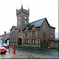
Drill Hall, Bridge Street
The administrative buildings, with tower, built in 1872, now converted to apartments. The actual hall, to the rear, no longer exists.
Image: © Alan Murray-Rust
Taken: 25 Jan 2018
0.04 miles
5
Drill Hall, Bridge Street - detail
Plaque with shield and motto. See http://www.geograph.org.uk/photo/5667401 for location.
Image: © Alan Murray-Rust
Taken: 25 Jan 2018
0.04 miles
6
Drill Hall, Bridge Street
The main entrance, dated 1872. The inscription refers to the 8th Cheshire Rifle Volunteers. See http://www.geograph.org.uk/photo/5667401 for location.
Image: © Alan Murray-Rust
Taken: 25 Jan 2018
0.05 miles
7
Former Drill Hall, Bridge Street
Cheshire Yeomanry (D Squadron) 7th Battalion, Cheshire Regiment (HQ, C & D Companies)
The building was used for drill during WW1. There was a rifle range in the basement, so a local gentleman told me; he and his wife used to go dancing there in the 1950s. It is now apartments.
Image: © Peter Barr
Taken: 30 Jun 2014
0.05 miles
8
The Picturedrome, Chestergate, Macclesfield
Built as the first purpose-built cinema in Macclesfield in 1911. Converted to offices in 2000.
Image: © Alan Murray-Rust
Taken: 25 Jan 2018
0.05 miles
9
Macclesfield Picturedrome
This early art deco building was opened in 1911 on Chestergate.
It is now offices but the original facade has been well-restored.
Image: © Jonathan Billinger
Taken: 17 Feb 2009
0.06 miles
10
Chestergate, Macclesfield
Taken from the end of the queue for "The Picturedrome" on the last night of the "Eat Out to Help Out" initiative
Image: © Philip Cornwall
Taken: 26 Aug 2020
0.07 miles


