IMAGES TAKEN NEAR TO
Gonville Avenue, MACCLESFIELD, SK11 0EG

Introduction

This page details the photographs taken nearby to Gonville Avenue, SK11 0EG by members of the Geograph project.

The Geograph project started in 2005 with the aim of publishing, organising and preserving representative images for every square kilometre of Great Britain, Ireland and the Isle of Man.

There are currently over 7.5m images from over14,400 individuals and you can help contribute to the project by visiting https://www.geograph.org.uk

Image Map


Images are licensed for reuse under creativecommons.org/licenses/by-sa/2.0
Notes
  • Clicking on the map will re-center to the selected point.
  • The higher the marker number, the further away the image location is from the centre of the postcode.

Image Listing (37 Images Found)

Images are licensed for reuse under creativecommons.org/licenses/by-sa/2.0
  • ...
Image
Details
Distance
1
St James's Church, Sutton
Built in 1840 to replace the former St George's Church in Lower Sutton, the new location being more convenient also for the village of Langley.
Image: © Alan Murray-Rust Taken: 26 Apr 2018
0.12 miles
2
St. James Church, Sutton
Built 1840.
Image: © Brian Deegan Taken: 1 May 2021
0.12 miles
3
St James
St James Church, Sutton Lane Ends.
Image: © Peter McDermott Taken: 9 Mar 2014
0.12 miles
4
St James's Church, Sutton Lane Ends
Image: © Colin Park Taken: 27 Feb 2022
0.12 miles
5
Sutton Well Dressing 2007
The marine flags along the top spell out SUTTON.
Image: © Neil Lewin Taken: 7 Jul 2007
0.14 miles
6
Sutton Lane Ends Bridge
An attractive stone bridge over the Rossendale Brook. Dated 1839 http://www.geograph.org.uk/photo/5760141 and Listed Grade II. View at road level, see also http://www.geograph.org.uk/photo/5760134
Image: © Alan Murray-Rust Taken: 26 Apr 2018
0.14 miles
7
House in Sutton Lane Ends
Creeper-clad house opposite the war memorial in the centre of Sutton Lane Ends.
Image: © Dave Dunford Taken: 1 Jun 2014
0.14 miles
8
Roofs and cottages, Sutton Lane Ends
Taken from Church Lane near the junction with Judy Lane.
Image: © Trevor Harris Taken: 6 Oct 2013
0.14 miles
9
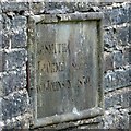
Sutton Lane Ends Bridge ? dedication stone
This records the local surveyors responsible for the bridge, with the date 1839. See http://www.geograph.org.uk/photo/5760134 for location.
Image: © Alan Murray-Rust Taken: 26 Apr 2018
0.15 miles
10
Sutton Lane Ends Bridge
An attractive stone bridge over the Rossendale Brook. Dated 1839 http://www.geograph.org.uk/photo/5760141 and Listed Grade II. There is no public access onto the riverside to get a better view.
Image: © Alan Murray-Rust Taken: 26 Apr 2018
0.15 miles
  • ...