IMAGES TAKEN NEAR TO
Buxton New Road, MACCLESFIELD, SK11 0AN
Introduction
This page details the photographs taken nearby to Buxton New Road, SK11 0AN by members of the Geograph project.
The Geograph project started in 2005 with the aim of publishing, organising and preserving representative images for every square kilometre of Great Britain, Ireland and the Isle of Man.

There are currently over 7.5m images from over14,400 individuals and you can help contribute to the project by visiting https://www.geograph.org.uk
Image Map
Images are licensed for reuse under creativecommons.org/licenses/by-sa/2.0
Notes
- Clicking on the map will re-center to the selected point.
- The higher the marker number, the further away the image location is from the centre of the postcode.
Image Listing (15 Images Found)
Images are licensed for reuse under creativecommons.org/licenses/by-sa/2.0
Image
Details
Distance
2
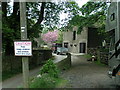
Hordern Farm
Several desirable dwellings clustered around the main house dated 1877.
Image: © Dave Dunford
Taken: 14 May 2006
0.03 miles
3
Hordern Farm
Three properties here at a converted farm, east of Macclesfield.
Image: © Peter Barr
Taken: 4 Aug 2014
0.03 miles
5
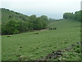
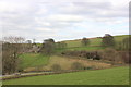
Gulshaw Hollow
From the footpath between Valeroyal and Holdern Farm.
Image: © Dave Dunford
Taken: 14 May 2006
0.18 miles
6
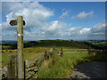
Footpath sign on Gritstone Trail
Looking north west towards Bollington. Manchester in the far distance.
Image: © Peter Barr
Taken: 4 Aug 2014
0.19 miles
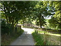
7
Newbuildings Farm
From the Gritstone Way.
Image: © Dave Dunford
Taken: 14 May 2006
0.20 miles
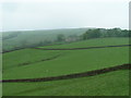
8
Gulshaw Hollow from the Gritstone Trail
Image: © Raymond Knapman
Taken: 26 Jun 2013
0.20 miles
9

A537 and Brink Farm
The road to Buxton from Macclesfield or Congleton are much beloved by motorcyclists for their winding character and are subjected to more accidents than other stretches of A-road. Brink Farm is located on an old road and became isolated with the arrival of the turnpike which is now the A537.
Image: © Peter Turner
Taken: 20 Mar 2012
0.21 miles
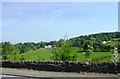
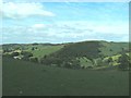
10
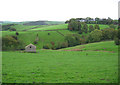
Farmland on the Gritstone Trail
Rolling pastureland around the Gritstone Trail. View from the junction of Buxton New Road and the lane to Rainow. Hordern Farm (in SJ9574) is out of frame on the right
Image: © Espresso Addict
Taken: 7 Oct 2006
0.21 miles