IMAGES TAKEN NEAR TO
Rainow, MACCLESFIELD, SK10 5UA

Introduction

This page details the photographs taken nearby to SK10 5UA by members of the Geograph project.

The Geograph project started in 2005 with the aim of publishing, organising and preserving representative images for every square kilometre of Great Britain, Ireland and the Isle of Man.

There are currently over 7.5m images from over14,400 individuals and you can help contribute to the project by visiting https://www.geograph.org.uk

Image Map


Images are licensed for reuse under creativecommons.org/licenses/by-sa/2.0
Notes
  • Clicking on the map will re-center to the selected point.
  • The higher the marker number, the further away the image location is from the centre of the postcode.

Image Listing (21 Images Found)

Images are licensed for reuse under creativecommons.org/licenses/by-sa/2.0
  • ...
Image
Details
Distance
1
Thornsett Farm
Part of the village of Rainow is visible to the left of the farm, and directly behind it the prominent hill is Big Low (Image). Taken from the Gritstone Way.
Image: © Dave Dunford Taken: 14 May 2006
0.03 miles
2
Track South of Thornsett Farm
Image: © Philip Cornwall Taken: 15 Aug 2021
0.11 miles
3
Footpath to Rainow
Image: © Chris Wimbush Taken: 15 Jul 2009
0.12 miles
4
Valley of The River Dean
Looking to Horndern Lane End Farm from Snipe House
Image: © Neil Theasby Taken: 31 Jul 2020
0.18 miles
5
Berristall Farm from Berristall Road
The wooded escarpment over the valley of the Dean is marked on the OS map as The Oaks.
Image: © Peter Turner Taken: 14 Feb 2012
0.19 miles
6
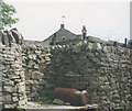
Rusty churn, Rainow
A rusty milk churn illustrates the former use of this ledge set into a dry stone wall. Note also the hole (dovecot?) in the gable of the farmhouse behind.
Image: © Stephen Craven Taken: 5 Jul 1992
0.19 miles
7
Holy Trinity Church, Rainow
Built 1846 - see http://www.rainow.org/ for more information on Rainow.
Image: © Dave Dunford Taken: 14 May 2006
0.20 miles
8
The parish church at Rainow
Image: © Colin Park Taken: 21 Mar 2007
0.20 miles
9
Tower Hill, Rainow
United Utilities entrance to reservoir on the right
Image: © Raymond Knapman Taken: 26 Jun 2013
0.21 miles
10
Rainow Church
Rainow Church nestled in the foot hills of the Peak Park
Image: © Dave Wilcox Taken: 23 Jan 2007
0.22 miles
  • ...