IMAGES TAKEN NEAR TO
Nursery Lane, MACCLESFIELD, SK10 4TX
Introduction
This page details the photographs taken nearby to Nursery Lane, SK10 4TX by members of the Geograph project.
The Geograph project started in 2005 with the aim of publishing, organising and preserving representative images for every square kilometre of Great Britain, Ireland and the Isle of Man.

There are currently over 7.5m images from over14,400 individuals and you can help contribute to the project by visiting https://www.geograph.org.uk
Image Map
Images are licensed for reuse under creativecommons.org/licenses/by-sa/2.0
Notes
- Clicking on the map will re-center to the selected point.
- The higher the marker number, the further away the image location is from the centre of the postcode.
Image Listing (10 Images Found)
Images are licensed for reuse under creativecommons.org/licenses/by-sa/2.0
Image
Details
Distance
6
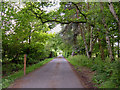
Entrance to Soss Moss Hall
Private entrance protected by much security. View south looking over the gate from Nursery Lane. Soss Moss Hall (in square SJ8275) is shown as an antiquity on the 1/25,000 map.
Image: © michael ely
Taken: 30 May 2006
0.20 miles
7
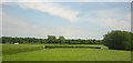
View south-eastward off the railway, near Corbishley Bridge
Image: © Christopher Hilton
Taken: 3 Jun 2016
0.23 miles