1
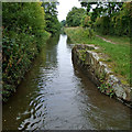
Hurdsfield Industrial Estate, Macclesfield
Heading towards the entrance to the Astra-Zeneca pharmaceuticals factory, a big local employer (though not as big as previously).
Image: © Peter Turner
Taken: 14 Feb 2012
0.05 miles
2
Hurdsfield Industrial Estate
Hulley Road, Macclesfield.
Image: © Peter Barr
Taken: 30 Jun 2014
0.10 miles
3
Astra Zeneca and other companies
Hurdsfield Industrial Estate, Hulley Road, Macclesfield.
Image: © Peter Barr
Taken: 30 Jun 2014
0.16 miles
4
Hurdsfield Industrial Estate
Viewed from Kerridge Road higher up the hill.
Image: © Stephen Craven
Taken: 27 Dec 2011
0.16 miles
5
Site of former bridge near Macclesfield in Cheshire
The former swing bridge (No 32) has been removed from this site on the Macclesfield Canal alongside the Hurdsfield Industrial Estate (off to the left).
Image: © Roger Kidd
Taken: 8 Sep 2014
0.21 miles
6
Site of former bridge near Macclesfield in Cheshire
The former swing bridge (No 32) has been removed from this site on the Macclesfield Canal, alongside the Hurdsfield Industrial Estate (off to the left).
Image: © Roger Kidd
Taken: 8 Sep 2014
0.21 miles
7
Site of former bridge near Macclesfield in Cheshire
The former swing bridge (No 32) has been removed from this site on the Macclesfield Canal, alongside the Hurdsfield Industrial Estate (off to the left).
Image: © Roger Kidd
Taken: 8 Sep 2014
0.21 miles
8
AstraZeneca's Hurdsfield Industrial Park premises hidden from the Macclesfield Canal
AstraZeneca's second largest manufacturing site and their European centre for packing, see; http://www.astrazeneca.co.uk/astrazeneca-in-uk/our-uk-sites/macclesfield
More about this part of the canal at; http://www.macclesfieldcanal.org.uk/mcmap2.htm
Image: © Chris Morgan
Taken: 23 May 2016
0.21 miles
9
Working narrowboat near Macclesfield, Cheshire
Narrowboat "Alton" sells coal, wood and diesel fuel, and rope fenders to boat owners, and has facilities to pump out boat toilet holding tanks. The boat was built in 1936 by Harland & Wolff Ltd in Woolwich. Her British Waterways number was 69770, her Grand Union Canal Carrying Company Ltd (GUCCCL) number was 102. She had 25 tons cargo carrying capacity. http://www.canal-network.com/info/furnessvale http://hnbc.org.uk/boats/alton
The boat is travelling south, and has just passed through the narrow section where a swing bridge (No 32) used to be. I see the price of (red) diesel is 85p a litre. That price varies greatly depending on world oil prices. Tax is supposed to be added if the fuel is for propulsion but not domestic heating of the vessel.
Image: © Roger D Kidd
Taken: 5 Sep 2014
0.21 miles
10
Macclesfield Canal towards bridge #30
Image: © Ian S
Taken: 3 Mar 2022
0.22 miles


