IMAGES TAKEN NEAR TO
Bramley Avenue, ROYSTON, SG8 6HG
Introduction
This page details the photographs taken nearby to Bramley Avenue, SG8 6HG by members of the Geograph project.
The Geograph project started in 2005 with the aim of publishing, organising and preserving representative images for every square kilometre of Great Britain, Ireland and the Isle of Man.

There are currently over 7.5m images from over14,400 individuals and you can help contribute to the project by visiting https://www.geograph.org.uk
Image Map
Images are licensed for reuse under creativecommons.org/licenses/by-sa/2.0
Notes
- Clicking on the map will re-center to the selected point.
- The higher the marker number, the further away the image location is from the centre of the postcode.
Image Listing (26 Images Found)
Images are licensed for reuse under creativecommons.org/licenses/by-sa/2.0
Image
Details
Distance
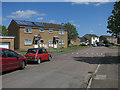
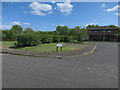
4
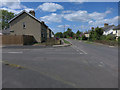
Worcester Way, Melbourn
As of the upload date this development does not yet show on the OS 1:50000 base map. It can be seen on the higher scale maps at streetmap, multimap & electionmaps.
Image: © Keith Edkins
Taken: 11 Jul 2007
0.07 miles
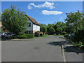
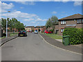
8
Melbourn: cycling down Drury Lane
Looking towards Cambridge Road on a bright June morning. The thatched house on the right is Grade II listed.
Image: © John Sutton
Taken: 13 Jun 2020
0.16 miles
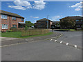
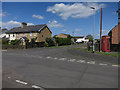
10
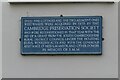
Information plaque on Sheepshead Row cottages
Image: © Philip Jeffrey
Taken: 16 Jul 2023
0.17 miles