IMAGES TAKEN NEAR TO
The Close, Limekiln Lane, BALDOCK, SG7 6PJ
Introduction
This page details the photographs taken nearby to The Close, Limekiln Lane, SG7 6PJ by members of the Geograph project.
The Geograph project started in 2005 with the aim of publishing, organising and preserving representative images for every square kilometre of Great Britain, Ireland and the Isle of Man.

There are currently over 7.5m images from over14,400 individuals and you can help contribute to the project by visiting https://www.geograph.org.uk
Image Map
Images are licensed for reuse under creativecommons.org/licenses/by-sa/2.0
Notes
- Clicking on the map will re-center to the selected point.
- The higher the marker number, the further away the image location is from the centre of the postcode.
Image Listing (10 Images Found)
Images are licensed for reuse under creativecommons.org/licenses/by-sa/2.0
Image
Details
Distance
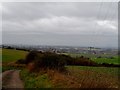
9
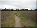
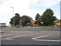
Footpath to Clothall Common, Baldock
Off Clothall Road.
Image: © Richard Vince
Taken: 10 Oct 2020
0.23 miles
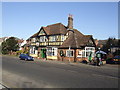
10

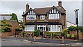
What was The Boot pub
Now being developed into flats
Image: © Philip Jeffrey
Taken: 4 Sep 2022
0.25 miles