IMAGES TAKEN NEAR TO
Bygrave Road, BALDOCK, SG7 5DD
Introduction
This page details the photographs taken nearby to Bygrave Road, SG7 5DD by members of the Geograph project.
The Geograph project started in 2005 with the aim of publishing, organising and preserving representative images for every square kilometre of Great Britain, Ireland and the Isle of Man.

There are currently over 7.5m images from over14,400 individuals and you can help contribute to the project by visiting https://www.geograph.org.uk
Image Map
Images are licensed for reuse under creativecommons.org/licenses/by-sa/2.0
Notes
- Clicking on the map will re-center to the selected point.
- The higher the marker number, the further away the image location is from the centre of the postcode.
Image Listing (45 Images Found)
Images are licensed for reuse under creativecommons.org/licenses/by-sa/2.0
Image
Details
Distance
2
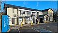
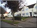
Larkins Close
From Baldock station platform.
Image: © Hugh Venables
Taken: 27 Apr 2011
0.05 miles
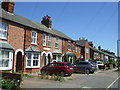
3
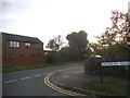
Salisbury Road at the junction with Bygrave Road
Image: © David Howard
Taken: 28 Sep 2017
0.06 miles
4
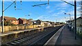
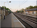
Baldock station, looking towards Cambridge
Image: © Chris Morgan
Taken: 29 Dec 2022
0.08 miles
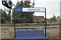
5
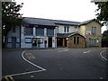
Baldock Railway Station
Tucked away in the corner of Baldock. Trains go North to Cambridge and South to London.
Image: © Robin Hall
Taken: 4 Sep 2005
0.08 miles

8
Baldock station
Looking towards Cambridge. See Image for a much earlier view in the opposite direction.
Image: © Hugh Venables
Taken: 27 Apr 2011
0.09 miles