
IMAGES TAKEN NEAR TO
Mullway, LETCHWORTH GARDEN CITY, SG6 4BH
Introduction
This page details the photographs taken nearby to Mullway, SG6 4BH by members of the Geograph project.
The Geograph project started in 2005 with the aim of publishing, organising and preserving representative images for every square kilometre of Great Britain, Ireland and the Isle of Man.

There are currently over 7.5m images from over14,400 individuals and you can help contribute to the project by visiting https://www.geograph.org.uk
Image Map
Images are licensed for reuse under creativecommons.org/licenses/by-sa/2.0
Notes
- Clicking on the map will re-center to the selected point.
- The higher the marker number, the further away the image location is from the centre of the postcode.
Image Listing (8 Images Found)
Images are licensed for reuse under creativecommons.org/licenses/by-sa/2.0
Image
Details
Distance
1

Broad path in Icknield Way Cemetery. Letchworth
Image: © Humphrey Bolton
Taken: 15 Aug 2026
0.18 miles
2
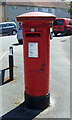
George V postbox on Bursland, Letchworth
Postbox No. SG6 170.
See Image] for context.
Image: © JThomas
Taken: 10 Jun 2017
0.19 miles
3
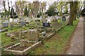
Icknield Way cemetery, Letchworth
This is the older, more tasteful end of the cemetery.
Image: © Ben Harris
Taken: 2 Apr 2011
0.19 miles
4
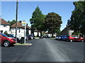
Bus stop on Bursland, Letchworth
Looking north.
Image: © JThomas
Taken: 10 Jun 2017
0.20 miles
5
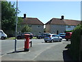
Abbotts Road, Letchworth
Showing position of Postbox No. SG6 170.
See Image] for postbox.
Image: © JThomas
Taken: 10 Jun 2017
0.20 miles
6

View in Icknield Way Cemetery, Letchworth
This is the western part of the cemetery.
Image: © Humphrey Bolton
Taken: 15 Aug 2026
0.21 miles
7

View in Icknield Way Cemetery, Letchworth
Many little cubes of hedge in this eastern part of the cemetery. They must take a long time to keep trimmed.
Image: © Humphrey Bolton
Taken: 15 Aug 2026
0.22 miles
8
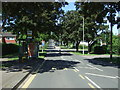
Bus stop and shelter on Bedford Road, Letchworth
Looking north west.
Image: © JThomas
Taken: 10 Jun 2017
0.23 miles