
IMAGES TAKEN NEAR TO
Nickleby Way, HITCHIN, SG5 4FJ
Introduction
This page details the photographs taken nearby to Nickleby Way, SG5 4FJ by members of the Geograph project.
The Geograph project started in 2005 with the aim of publishing, organising and preserving representative images for every square kilometre of Great Britain, Ireland and the Isle of Man.

There are currently over 7.5m images from over14,400 individuals and you can help contribute to the project by visiting https://www.geograph.org.uk
Image Map
Images are licensed for reuse under creativecommons.org/licenses/by-sa/2.0
Notes
- Clicking on the map will re-center to the selected point.
- The higher the marker number, the further away the image location is from the centre of the postcode.
Image Listing (23 Images Found)
Images are licensed for reuse under creativecommons.org/licenses/by-sa/2.0
Image
Details
Distance
1

Fairfield Park - cricket ground
This used to be a county standard pitch. Bedfordshire have played her. So have I many years on. Nearly had my head knocked off - needs attention.
Image: © Robin Hall
Taken: 30 Oct 2005
0.10 miles
2
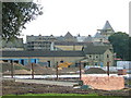
Building work - Fairfield Park
Building work in progress. The turret to the right is the roof of the old secure unit.
Image: © Robin Hall
Taken: 30 Oct 2005
0.15 miles
3
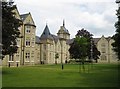
Stotfold: Former Three Counties Lunatic Asylum (2)
Please see Image for a brief history.
This is the southern and front façade of the western of the two wings completed by 1881. The tower beyond the corner is the same one visible in the above photograph. The overall impression of the exterior of the building is one of lightness with a vague feeling of a French chateau or an Oxbridge quadrangle.
Image: © Nigel Cox
Taken: 13 Jun 2010
0.17 miles
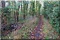
5
Footpath out of Fairfield into the woods
Image: © Philip Jeffrey
Taken: 30 Oct 2022
0.18 miles
6
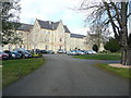
The central entrance to Fairfield Hall
This was built as the Three Counties Asylum in the mid-19C. When completed c.1870 it had 1000 beds. It has been converted to apartments. The OS map shows that the main driveways are rights-of-way, although there are signs denying this. See https://www.fairfieldparishcouncil.gov.uk/does-kingsley-avenue-have-public-access-rights/ .
Image: © Humphrey Bolton
Taken: 20 Mar 2018
0.18 miles
7
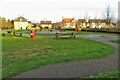
Play area by Dickens Boulevard Fairfield
Image: © Philip Jeffrey
Taken: 30 Oct 2022
0.19 miles
8
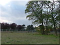
Fairfield Park
This dull and uninspiring photo is of the site of the old London Chest Hospital. On the 1940's map you can see a crescent shaped building which had open but covered verandas where patients suffering from TB would be wheeled into the cold air to get better. Later this was used as a psychiatric hospital but with the closure of the large hospitals in the 1990's the land was bought up for development. Work is still in progress.
Image: © Robin Hall
Taken: 30 Oct 2005
0.19 miles
9
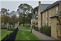
Houses facing onto parkland, Fairfield Park
In the grounds of the former Fairfield Hospital.
Image: © David Martin
Taken: 13 Nov 2022
0.19 miles
10
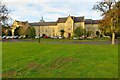
Front of Fairfield Hall, now apartments
Image: © Philip Jeffrey
Taken: 30 Oct 2022
0.19 miles